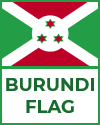
Burundi is a small, landlocked country located in East-Central Africa, bordered by Rwanda to the north, Tanzania to the east and south, and the Democratic Republic of the Congo to the west. Despite its modest size, Burundi has a varied and striking geography. The country lies on a high plateau, with elevations ranging from 770 meters (2,500 feet) along Lake Tanganyika to over 2,600 meters (8,500 feet) in the mountainous regions of the west. The western border is dominated by the Rift Valley and the long, narrow Lake Tanganyika, one of the deepest and oldest freshwater lakes in the world.
The central plateau region features fertile hills and valleys, supporting much of Burundi's agriculture. The eastern part of the country transitions into lower, flatter plains. Numerous rivers, including the Ruvubu and Malagarasi, flow through Burundi and eventually drain into larger water systems.
Burundi's climate is generally equatorial, with moderate temperatures due to its elevation. There are two wet seasons and two dry seasons, influencing agricultural cycles and water availability. The country's diverse ecosystems range from mountainous forests to wetlands, providing habitats for a variety of wildlife. Despite its natural beauty, deforestation and soil erosion remain pressing environmental challenges due to population pressure and intensive land use.
|


