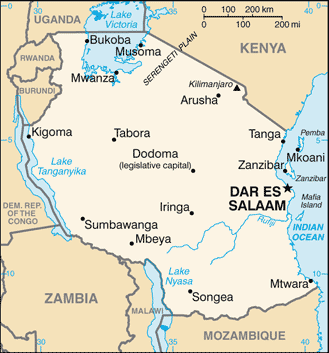
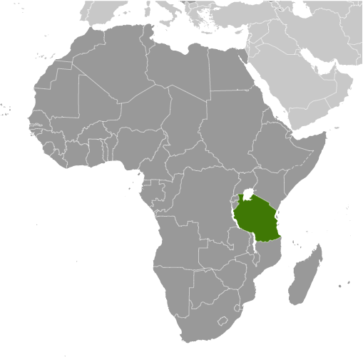
Learning about Tanzania's geography is pivotal because it helps your K-12 students understand how a country can be home to Africa's highest peak, largest lake, and most famous wildlife parks. Tanzania sits in East Africa, bordered by Kenya, Uganda, Rwanda, Burundi, the Democratic Republic of the Congo, Zambia, Malawi, and Mozambique, with a coastline on the Indian Ocean. It also includes the islands of Zanzibar and Pemba. Mount Kilimanjaro, Africa's highest mountain, rises in the northeast, while Lake Victoria, Africa's largest lake, lies to the northwest.
Studying Tanzania builds key geographic skills. Your pupils can explore how mountains, lakes, and coastal plains create many climates and ways of life. They can also learn how farming, tourism, and mining connect Tanzania to global markets. The Serengeti Plain hosts the Great Migration, where millions of wildebeest and zebras travel each year, making it one of the world's greatest wildlife spectacles.
The country's cultural geography is rich, with over 120 ethnic groups and languages like Swahili, which is widely spoken. For your young learners, Tanzania is memorable because of Kilimanjaro, the Serengeti, and Zanzibar's beaches. Studying it builds map skills, cultural awareness, and understanding of how geography shapes a nation's identity and economy.
|