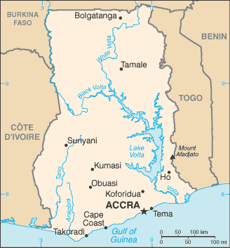
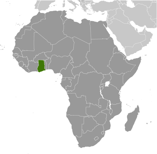
Learning about Ghana's geography is important because it assists your K-12 students to understand how location and natural resources shape a nation's history and future. Ghana sits in West Africa, bordered by Côte d'Ivoire, Burkina Faso, and Togo, with the Gulf of Guinea to the south. The country has a warm, tropical climate with rainforests in the southwest, savanna in the north, and sandy beaches along the coast. Lake Volta, one of the world's largest man-made lakes, stretches across the east and provides hydroelectric power.
Studying Ghana builds key geographic skills. Students can explore how rainfall and soil affect farming, especially cocoa, which Ghana is famous for, along with gold and oil. They can also learn how the Volta River and its dams support energy and transportation. Ghana's coastal forts, like Cape Coast Castle, connect geography to the painful history of the transatlantic slave trade.
The country's cultural geography is rich, with groups like the Akan, Ewe, and Ga speaking many languages. Ghana was the first African nation south of the Sahara to gain independence, in 1957, making it a symbol of freedom. For your young students, Ghana is memorable because of its cocoa farms, gold, and vibrant festivals. Studying it builds map skills, cultural awareness, and understanding of how geography shapes history and identity.
|