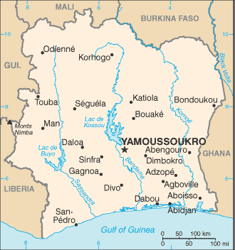
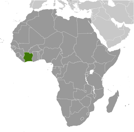
Learning about Côte d'Ivoire's geography is important because it helps your K-12 students understand how a small nation can become a major player in global trade. Côte d'Ivoire sits in West Africa, bordered by Liberia, Guinea, Mali, Burkina Faso, and Ghana, with the Atlantic Ocean to the south. The country has a humid tropical south with dense rainforests and a drier savanna north. The southern coast is lined with lagoons and beaches, while rivers like the Bandama flow south toward the Gulf of Guinea.
Studying Côte d'Ivoire builds key geographic skills. Your students can explore how climate zones shape agriculture, especially cocoa and coffee, which thrive in the hot, wet south. Côte d'Ivoire is the world's largest cocoa producer, so chocolate lovers everywhere depend on its farms. Students can also examine how the capital moved from Abidjan to Yamoussoukro, showing how geography connects to politics and planning. Abidjan remains the economic center and one of West Africa's largest cities.
The country's cultural geography is rich, with over sixty ethnic groups, including the Akan, Baule, and Senoufo. French is the official language, but many local languages are spoken. For your young learners, Côte d'Ivoire is memorable because of its cocoa farms, vibrant music, and diverse people. Studying it builds map skills, cultural awareness, and understanding of how geography shapes global supply chains.
|