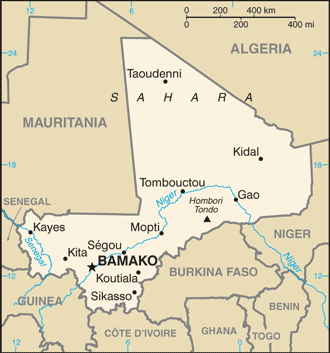
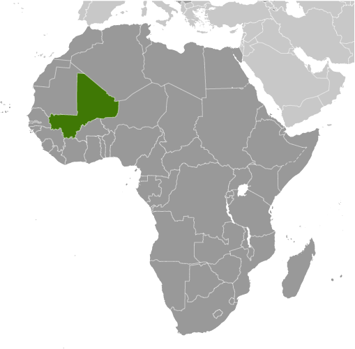
Learning about Mali's geography is important because it helps your K-12 students understand how a landlocked country in West Africa became home to powerful empires and enduring cultures. Mali is bordered by seven nations, including Algeria, Niger, and Senegal, and has no coastline. The Sahara Desert covers the north, while the Niger River curves through the center and south, creating a fertile inland delta. This river is the country's lifeline, supporting farming, fishing, and trade for centuries.
Studying Mali builds key geographic skills. Your K-12 students can examine how desert and savanna climates shape where people live, and why towns cluster along the Niger River. They can also learn how geography helped Mali's ancient empires – Ghana, Mali, and Songhai – grow rich from gold and salt trade routes across the Sahara. Cities like Timbuktu and Djenné became famous centers of learning and commerce.
Today, Mali faces challenges like desertification and conflict, showing how geography connects to modern issues. Its cultural geography is rich, with Bambara, Fulani, Tuareg, and other groups speaking many languages. Music and oral storytelling traditions remain strong. For young learners, Mali is memorable because of its legendary past, the Niger River, and mud-brick mosques. Studying it builds map skills, cultural awareness, and understanding of how geography shapes history.
|