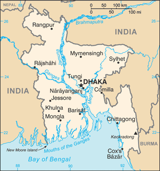
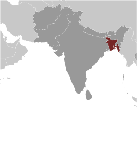
Learning about Bangladesh's geography is helpful because it shows K-12 students how rivers, floods, and dense settlement shape everyday life in one of the world's most crowded countries. Bangladesh sits in South Asia, bordered by India on three sides and Myanmar to the southeast, with the Bay of Bengal to the south. It is built mostly on the huge delta where the Ganges, Brahmaputra, and Meghna rivers meet. These rivers carry enormous amounts of water and sediment, creating fertile soil but also causing regular flooding.
Studying Bangladesh builds key geographic skills. Students can explore how delta geography supports rice farming, which feeds millions of people. They can also learn how monsoon rains, cyclones, and rising sea levels make Bangladesh one of the most vulnerable countries to climate change. Many scientists study it to understand how people adapt to flooding and storms.
The country's cultural geography is rich, with Bengali language, music, and food like rice and fish curry. For young learners, Bangladesh is memorable because of its rivers, rickshaws, and the Sundarbans mangrove forest, home to Bengal tigers. Studying it builds map skills, cultural awareness, and understanding of how geography shapes a nation's challenges and resilience in the face of natural hazards.
|