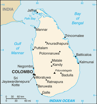
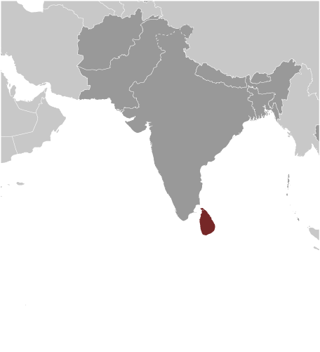
Learning about Sri Lanka's geography is helpful because it shows K-12 students how an island's shape, climate, and location shape its culture and economy. Sri Lanka sits in the Indian Ocean, just south of India, and is separated from the mainland by the Palk Strait. The island is often called the "Pearl of the Indian Ocean" because of its teardrop shape. Its center is dominated by highlands, including Pidurutalagala, the highest peak, while coastal plains ring the island. Rivers flow from the wet highlands to the sea, supporting farming and transportation.
Studying Sri Lanka builds key geographic skills. Students can explore how monsoon winds create a wet zone in the southwest and a dry zone in the north and east, affecting where tea, rubber, and rice grow. They can also learn how the island's location made it a historic hub for trade between East and West, and how its coastline supports fishing and tourism.
The country's cultural geography is rich, with Sinhalese, Tamil, and other groups speaking multiple languages. Buddhism, Hinduism, Islam, and Christianity all shape daily life. For young learners, Sri Lanka is memorable because of its elephants, tea plantations, and ancient cities. Studying it builds map skills, cultural awareness, and understanding of how geography shapes an island nation's identity and economy.
|