Corregidor Relief Map Display | Student Handouts
 Welcome to Student Handouts--www.studenthandouts.com! 100% free teaching materials for students in kindergarten through high school--lesson plans, worksheets, PowerPoints, outlines, interactive games, puzzles, and so much more!
 
Corregidor Relief Map Display
www.studenthandouts.comGeographyAsiaSE AsiaPhilippinesPhilippines Images
 
 
Corregidor Relief Map Display
 
 
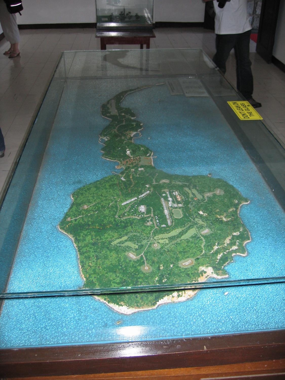
A scale relief map of the tadpole-shaped island of Corregidor (in the Philippines). The island is 6 kilometers (4 miles) long and 2.4 kilometers (1.5 miles) at its widest point, with an area of 5 square kilometers (2 square miles) and a highest elevation of 121 meters (397 feet). The island, part of an ancient volcanic caldera, divides the entrance to Manila Bay into two main passages, North Channel and South Channel. Construction of fortifications on Corregidor began as early as 1904 as part of the Manila harbor defenses and were primarily designed to meet a seaborne attack. Click here to enlarge.
 
 
Save with our freebies for teachers! William Caxton (1412-1491) Pride and Prejudice by Jane Austen Literary Classics Workbook Name the Midwestern State Online Map Quiz Yearly Calendar on a Single Sheet PDF The Road to Revolution Matching Game
 
 
www.studenthandouts.comGeographyAsiaSE AsiaPhilippinesPhilippines Images