
| Philippines Image Gallery |
|---|
| www.studenthandouts.com ↣ World Geography ↣ Asia ↣ Southeast Asia ↣ Philippines ↣ Images of the Philippines |
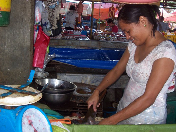 Filipino fish market. An archipelago south of Japan, the Philippines contains numerous fisherfolk. Fish is a mainstay of the Filipino diet. A fish market, such as that pictured here, is a common sight. Consumers are able to regularly eat fish that were caught that same day. Photograph taken in Luzon, Philippine Islands.
|
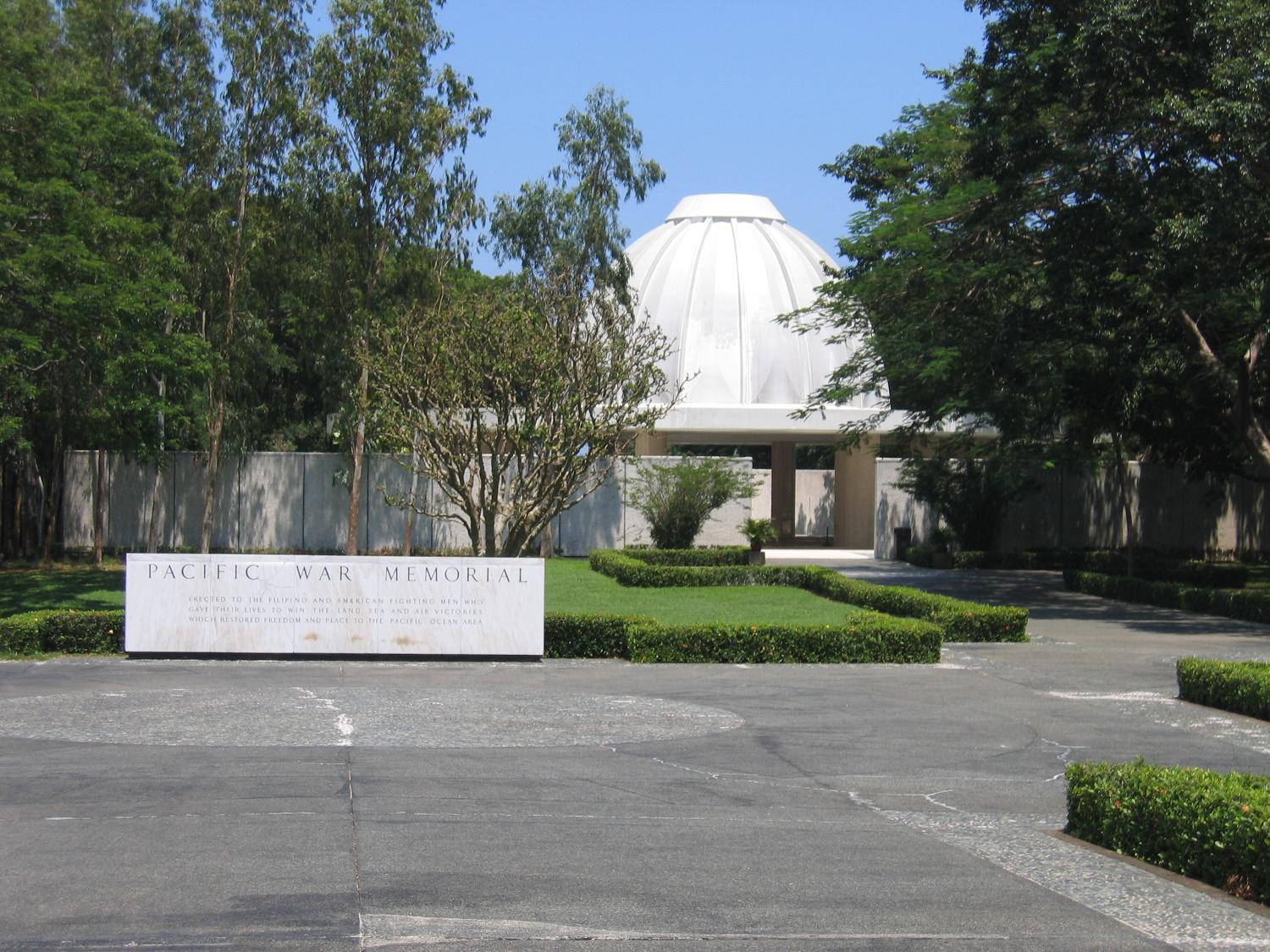 The entrance to the Pacific War Memorial building on the island of Corregidor in Manila Bay, Philippine Islands (World War II). Inscription: "Erected to the Filipino and American fighting men who gave their lives to win the land, sea, and air victories which restored freedom and peace to the Pacific Ocean area."
|
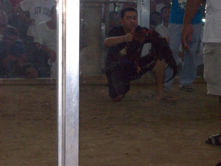 A Filipino cockfight.
Cockfighting is a popular sport around the world, particularly in former Spanish colonies (such as the Philippines). Cocks fight until the death while spectators bet on the winner. Photograph taken in Luzon, Philippine Islands. |
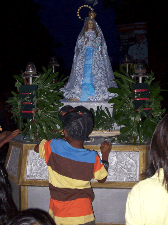 Santa Cruzon festival float.
A former Spanish colony, the Philippines is a predominantly Catholic country. Filipino religious festivals are plentiful and well-attended. This picture was taken in Talisay, Batangas, Philippine Islands. |
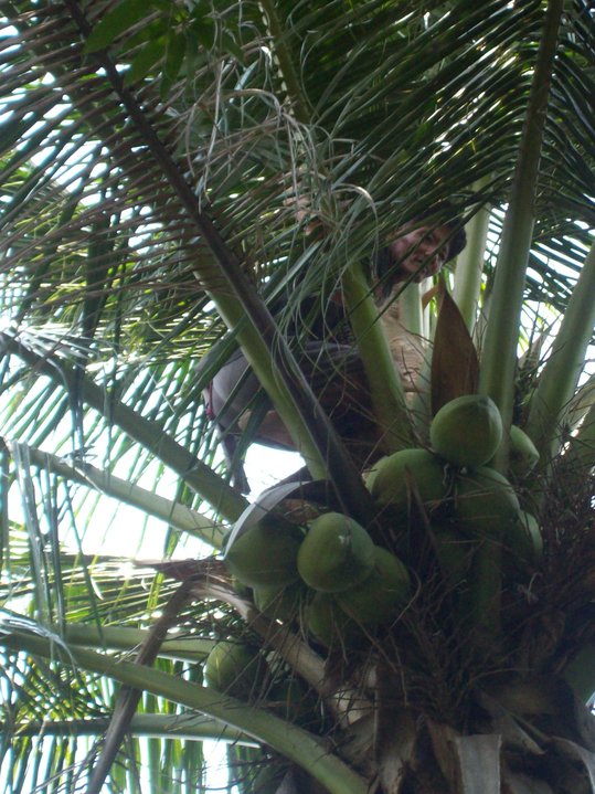 A Filipino fruit picker.
Widespread poverty throughout the Philippines means that no one of means need pick his or her own fruit. For the equivalent of pennies, fruit pickers will climb trees (this one is approximately 30 feet high) without safety equipment or tools, in order to pick fruit and toss it down to those below. Photograph taken in Balas, Talisay, Batangas, Philippine Islands. |
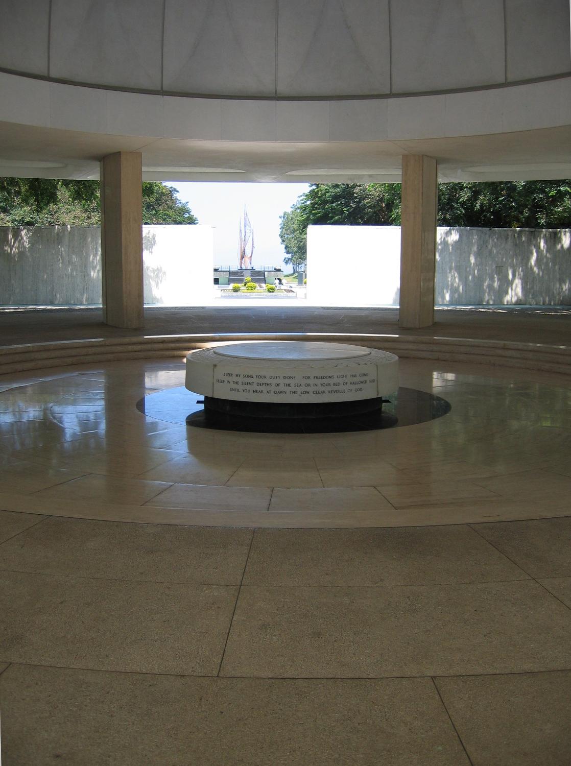 Inside the Pacific War Memorial (World War II) building, Corregidor.
Inscription: "Sleep, my sons, your duty done, for freedom's light has come. Sleep in the silent depths of the sea, or in your hallowed sod, until you hear at dawn the low clear reveille of God." |
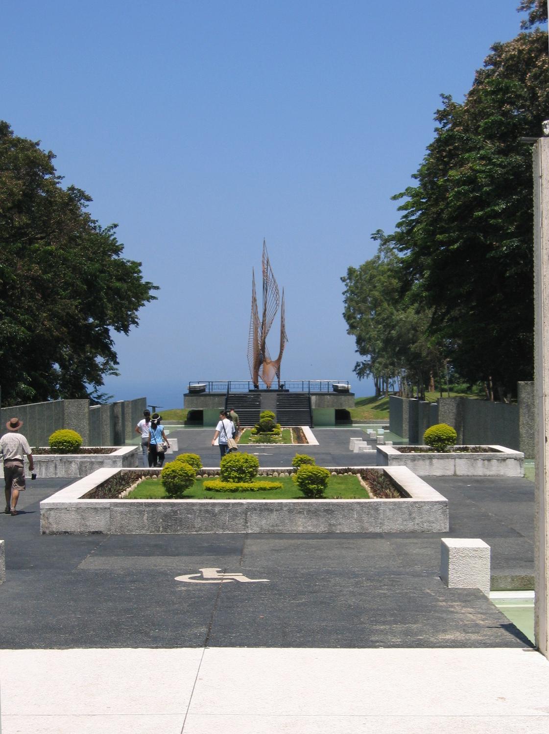 On the grounds of the Pacific War Memorial, Corregidor, Philippines.
The sculpture is entitled the "Eternal Flame of Freedom." The Philippine Islands was a major battleground of World War II. The island nation was invaded by Japanese forces in 1942. |
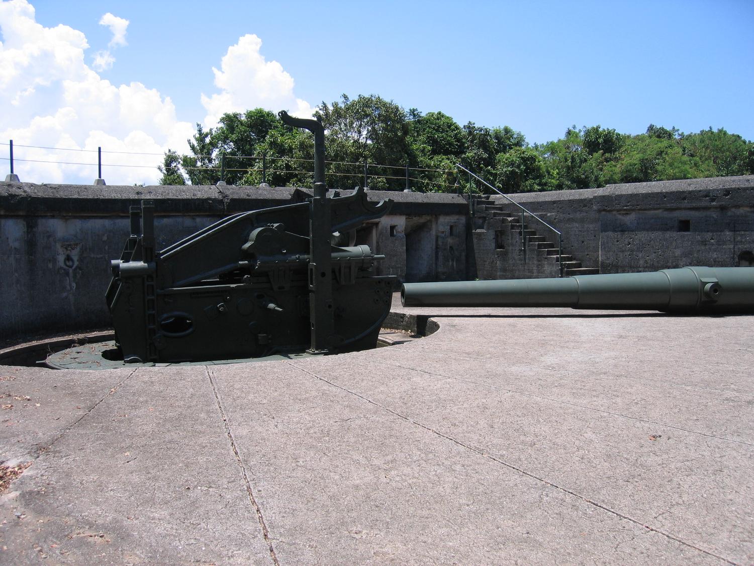 A 10-inch coast artillery gun and a "disappearing" mount emplaced in Battery Grubbs on Fort Mills (World War II, Corregidor). This type of mount is designed to employ a hinged counterweight to raise the gun for firing above the parapet of the gun emplacement and then to recoil back and down under cover for reloading. Fort Mills had 23 batteries with 56 coast artillery guns and mortars, of which six batteries were equipped with disappearing mounts. In addition, there were 13 anti-aircraft batteries with 76 guns.
|
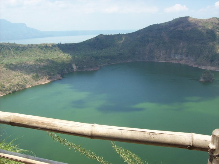 Crater, containing a rain-filled lake, of Taal Volcano. Taal Volcano is located on the Filipino island of Luzon, in Batangas, Philippines. The thin bamboo rail seen in the photograph is the only safety barrier between tourists and the volcano's crater. The Philippines is a favorite tourist destination in Asia.
|
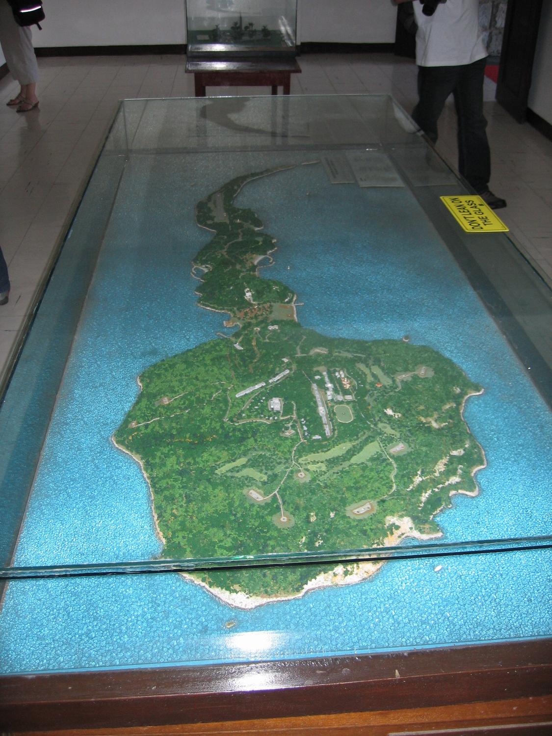 A scale relief map of the tadpole-shaped island of Corregidor (in the Philippines).
The island is 6 kilometers (4 miles) long and 2.4 kilometers (1.5 miles) at its widest point, with an area of 5 square kilometers (2 square miles) and a highest elevation of 121 meters (397 feet). The island, part of an ancient volcanic caldera, divides the entrance to Manila Bay into two main passages, North Channel and South Channel. Construction of fortifications on Corregidor began as early as 1904 as part of the Manila harbor defenses and were primarily designed to meet a seaborne attack. |
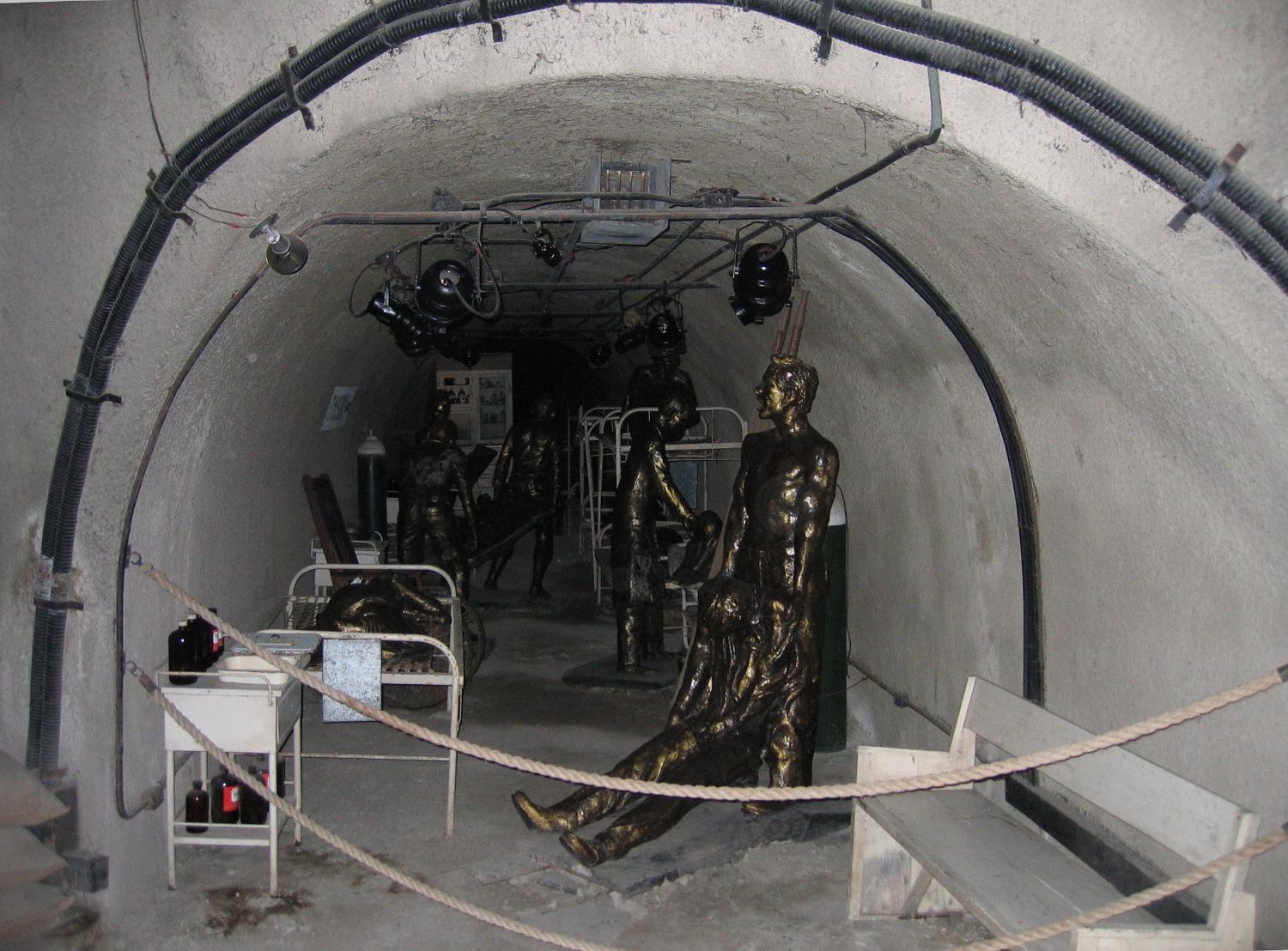 Certain lateral tunnels of the Malinta Tunnel complex present dioramas that show what life was like inside the tunnels.
This display represents one of the hospital laterals and depicts the treatment of the wounded. |
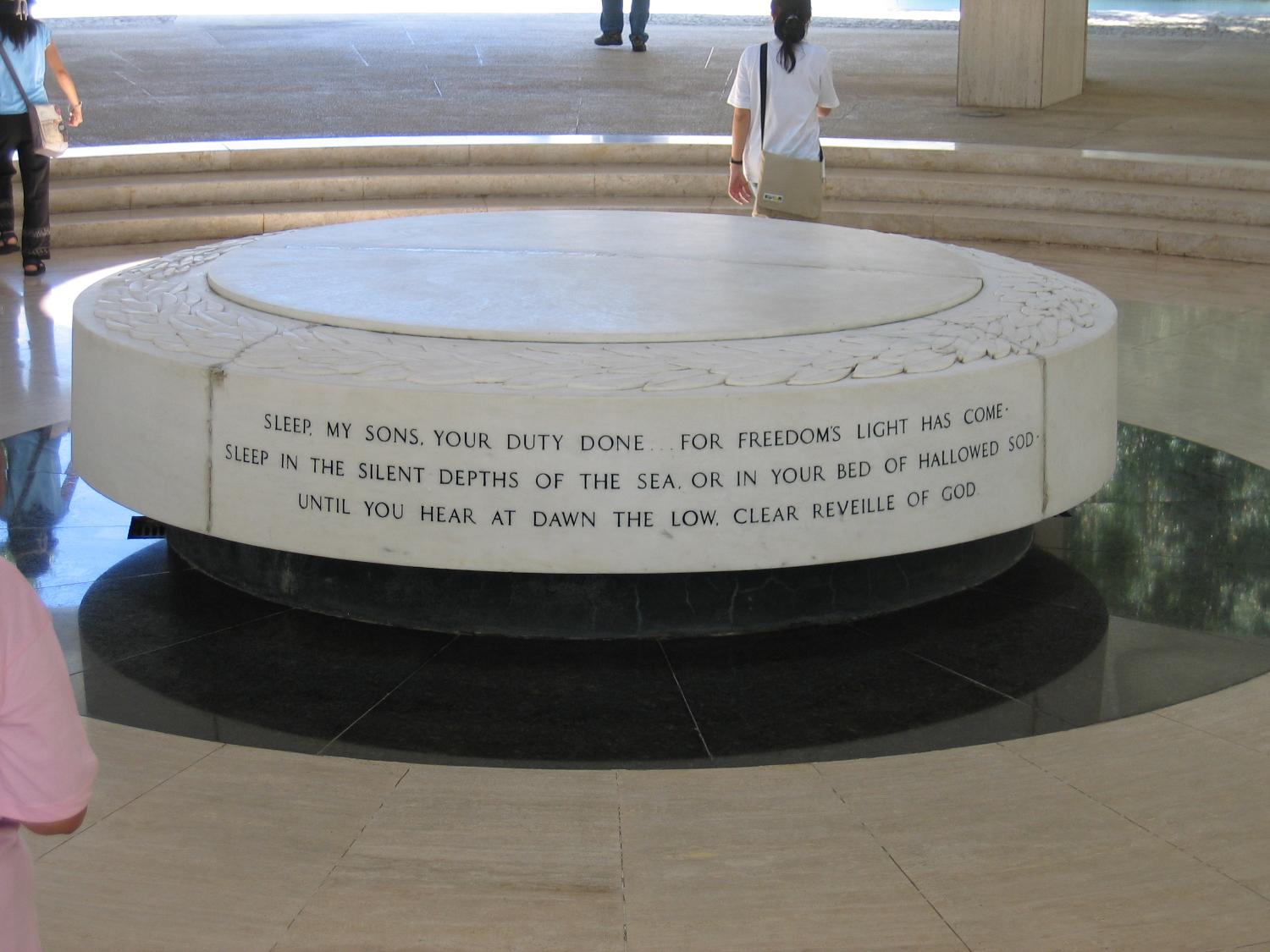 Memorial altar in the Pacific War Memorial building, Corregidor, Philippines. At noon on the 6th of May every year, sunlight shining through the oculus (round ceiling opening) falls directly on the center of the altar, marking the time of the surrender of Corregidor and the Philippines to the Japanese in 1942 (World War II).
|
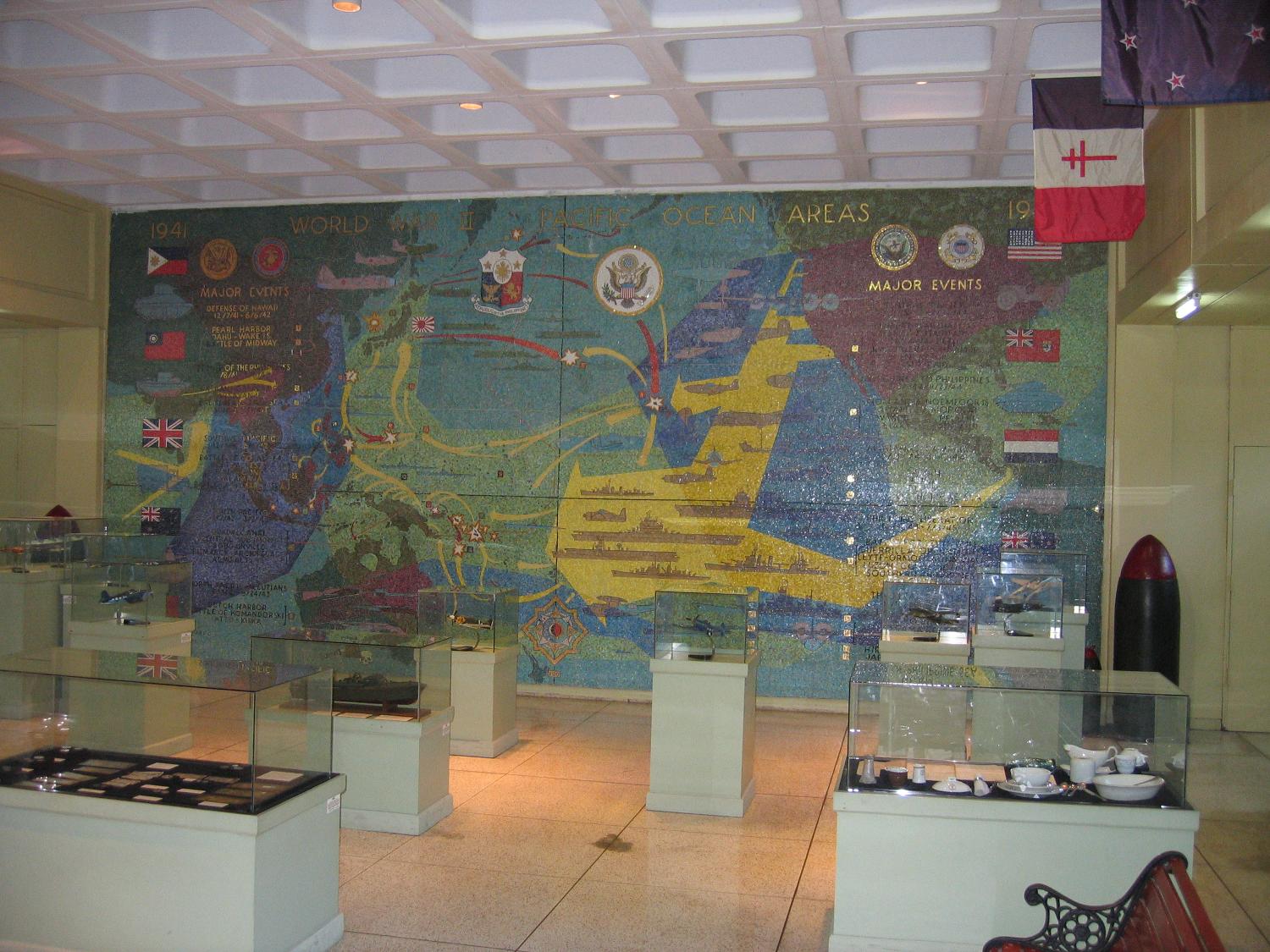 Displays inside the Pacific War Memorial Museum in Corregidor, Philippines.
The wall mural details the events of the Pacific battles of World War II. |
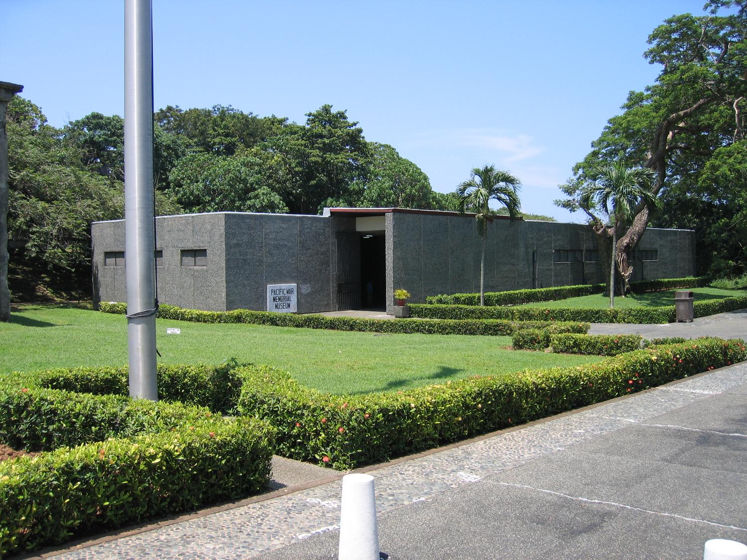 The Pacific War Memorial Museum in Corregidor, Philippines: Commemorated are atrocities such as the Bataan Death March. The Japanese invaded the Philippines in 1942 (World War II). The country was later liberated by Filipino and United States forces.
|
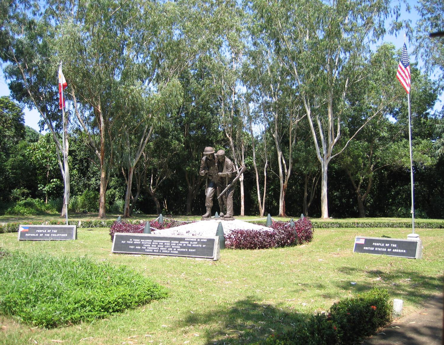 The 3 meters (10 feet) bronze sculpture entitled "Brothers in Arms" highlights the Filipino-American Friendship Park on the island of Corregidor in the Philippines. The park lies directly behind the Pacific War Memorial. The Filipino resistance movement, along with United States troops, successfully forced Japanese invaders out of the country during World War II.
Inscription: "In these hallowed surroundings where heroes sleep, may their ashes scatter with the wind and live in the hearts of those who were left behind. They died for freedom's right and in heaven's sight theirs was a noble cause." |
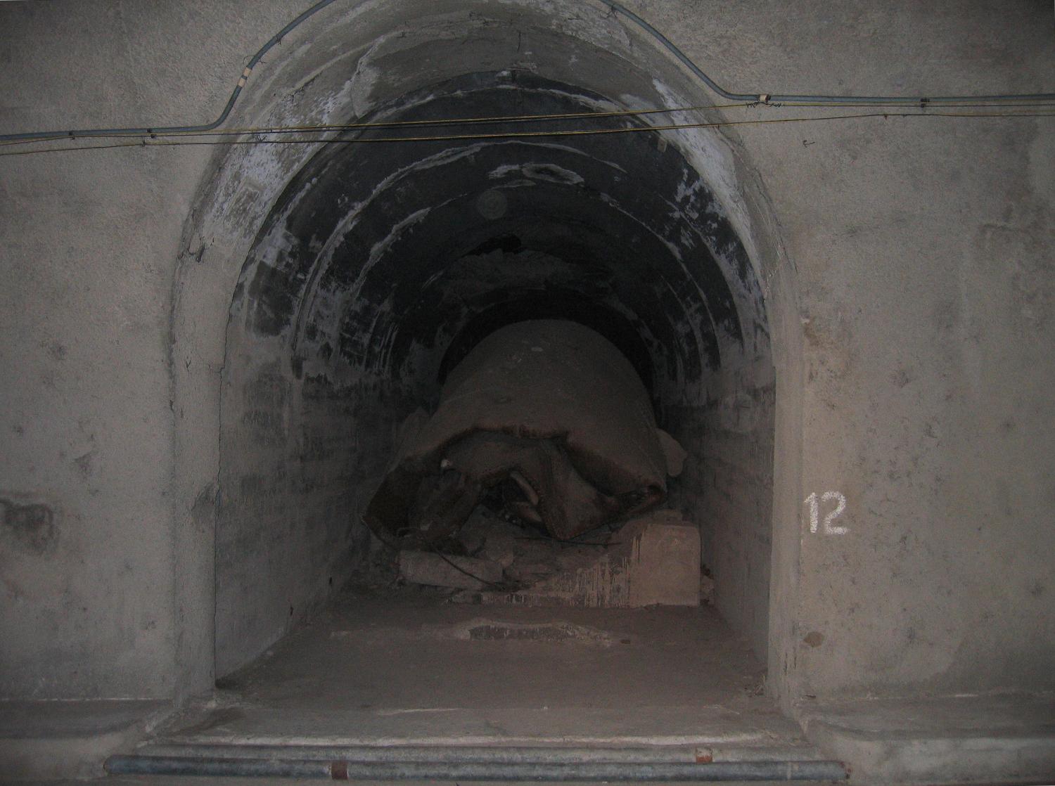 This lateral tunnel of the Malinta Tunnel complex was part of an underground fuel storage area. The collapsed fuel tank sits on a concrete cradle. Some of the lateral tunnels were collapsed when Japanese defenders blew themselves up during the recapture of the island by United States and Filipino forces (February 23, 1945). The collapsed laterals have never been excavated. Philippines, World War II.
|
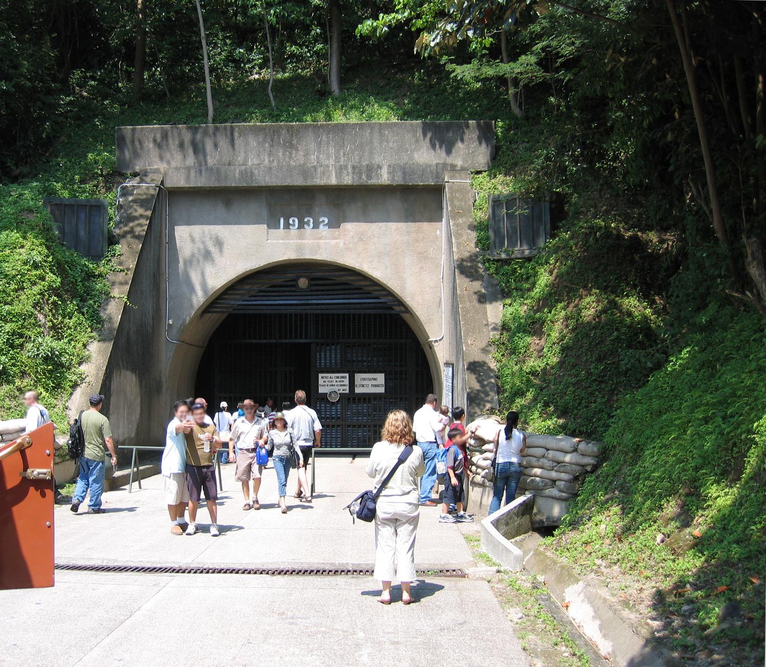 East entrance to the Malinta Tunnel complex on the island of Corregidor in the Philippine Islands. Constructed by the U.S. Army Corps of Engineers between 1922 and 1932, it was used for bomb-proof storage, as a command center, and a 1,000-bed hospital. The main east-west tunnel is 235 meters (830 feet) long and 7.3 meters (24 feet) wide, with 24 lateral tunnels, each about 49 meters (160 feet) long and 4.6 meters (15 feet) wide. A double track electric railway ran down the main tunnel. General Douglas MacArthur's headquarters and the offices of President Manuel L. Quezon of the Philippines Commonwealth were located in laterals just inside this entrance (World War II).
|
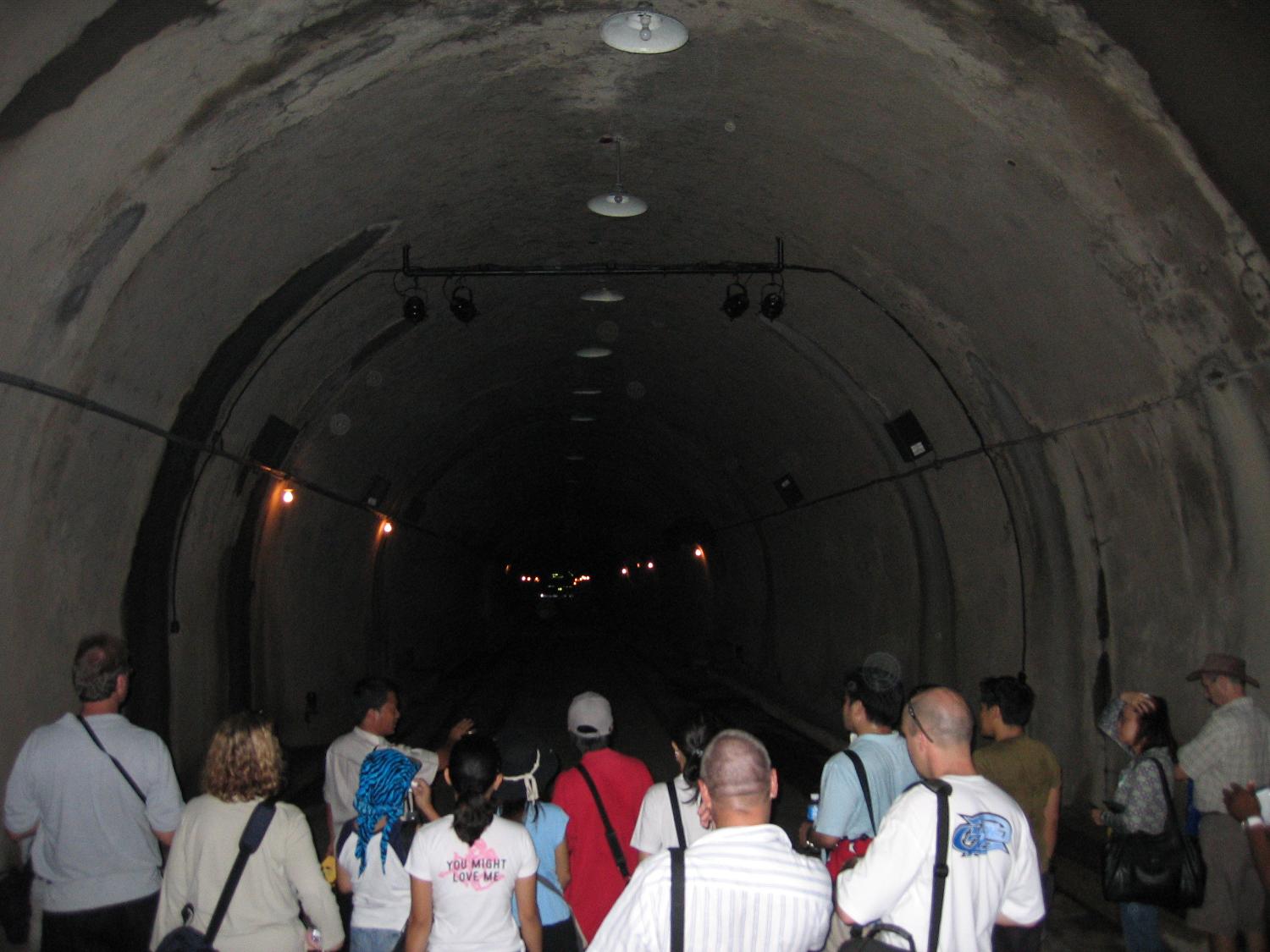 Inside the Malinta Tunnel complex on the island of Corregidor in the Philippines. During the Battle of Corregidor (December 29, 1941-May 6, 1942, World War II) one of the lateral tunnels served as the headquarters of General Douglas MacArthur, leader of the U.S. Army Forces in the Far East, while another lateral served as the seat of government for the Commonwealth of the Philippines.
|
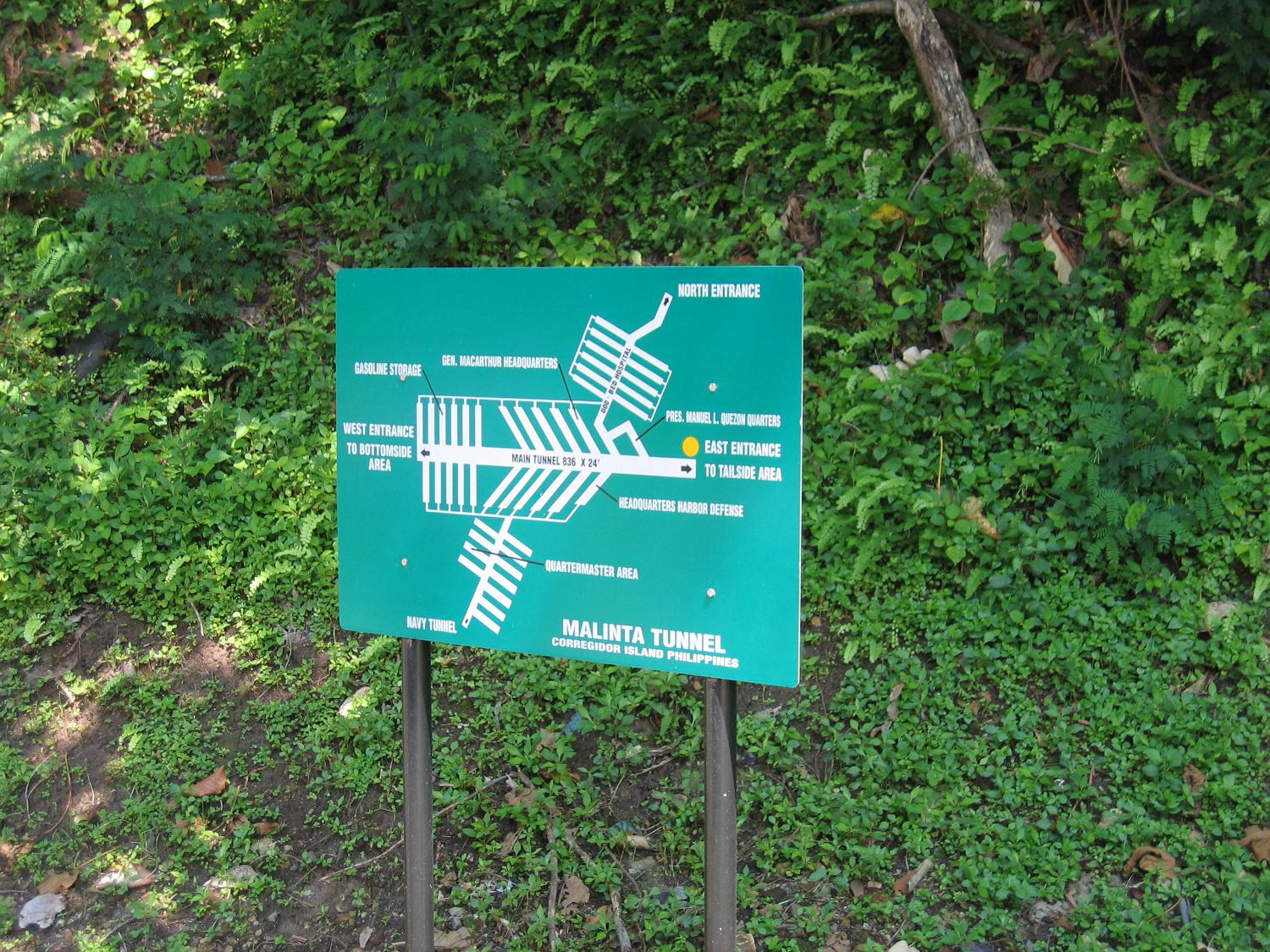 Map of the Malinta Tunnel complex on the island of Corregidor, Philippines.
Includes the headquarters of General Douglas MacArthur and President Manuel L. Quezon (World War II). |
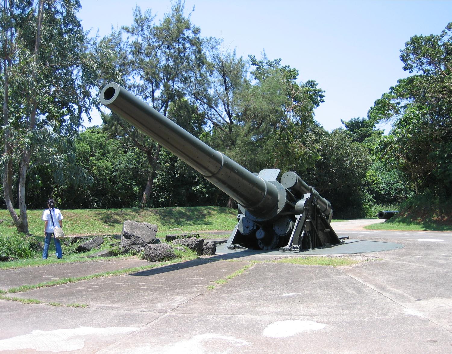 A 12-inch seacoast gun emplaced at Battery Hearn on Fort Mills (Corregidor, Philippines). Battery Hearn was one of the last fortifications built on Fort Mills prior to limitations of the Washington Naval Treaty taking effect in the 1920s. The 12-inch guns were the longest range weapons (27 kilometers; 16 miles) on Corregidor and fired on Japanese forces on Bataan Peninsula. Following the surrender of Corregidor on May 6, 1942, Battery Hearn was the scene of a famous photograph of Japanese soldiers celebrating their victory on top of the guns (World War II).
|
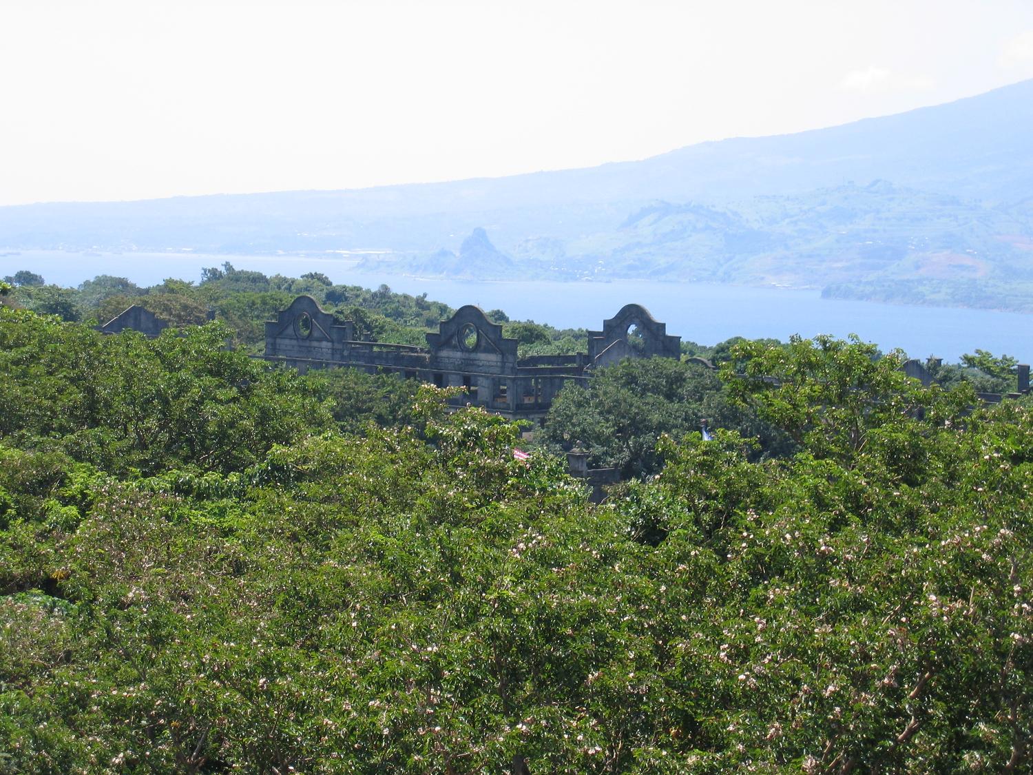 A view of Topside—the highest area of Corregidor—taken from the vicinity of the Spanish Lighthouse. Shown are the remains of the "Mile-Long Barracks" barely visible above the trees. These main barracks on the Topside section housed the troops of the coast artillery battalions who manned the island defenses. The building was a three-story concrete structure designed to be hurricane proof while providing comfortable, airy accommodations in a tropical environment. Despite the fact it never was a mile long when built, the structure was considered to be the longest barracks in the world. In the background, across the North Channel, are the mountains of Bataan Peninsula overlooking Corregidor, Philippines.
|
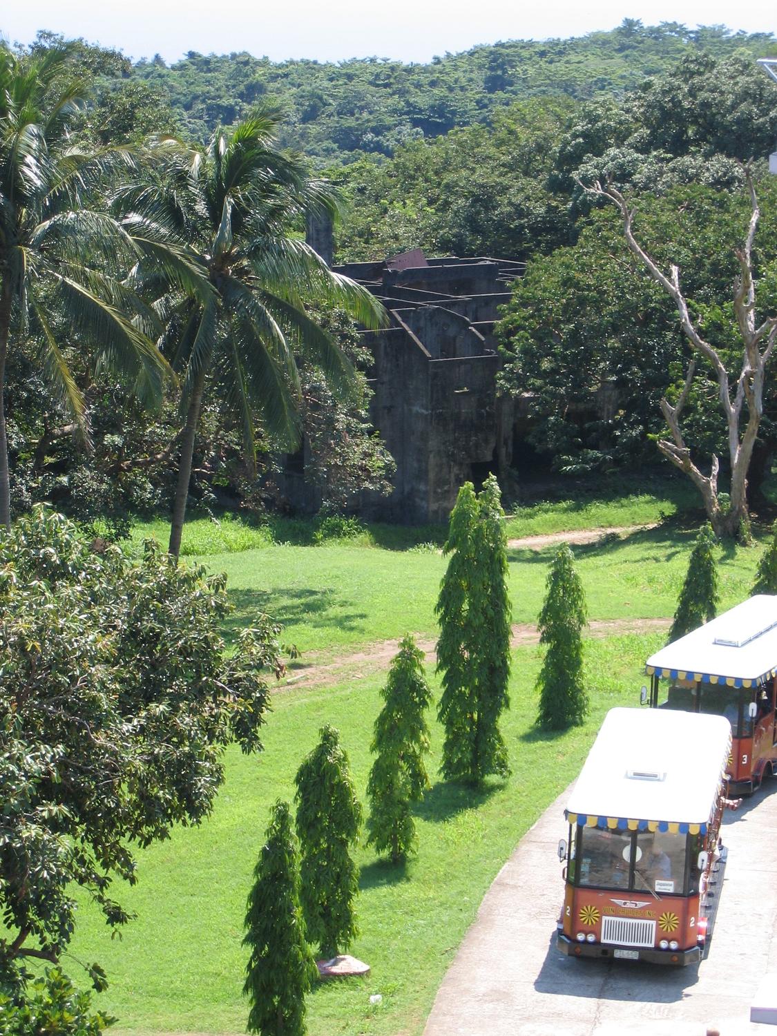 Tour busses pause in the vicinity of the Spanish Lighthouse on the island of Corregidor.
In the background, amid the trees, are the remains of one of the senior officer's family quarters. |
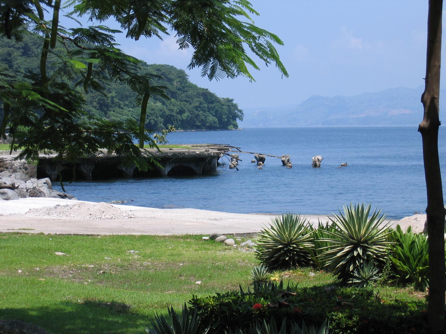 A crumbling old pier on the island of Corregidor in the Philippines.
The Philippines is an archipelago (a chain of islands) in southeast Asia. |
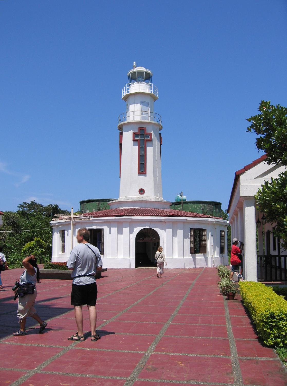 The Spanish first constructed a lighthouse on Corregidor in 1836, then rebuilt it in 1853 on the highest point of the island.
The lighthouse was destroyed during the World War II battle, but was reconstructed after the war. |
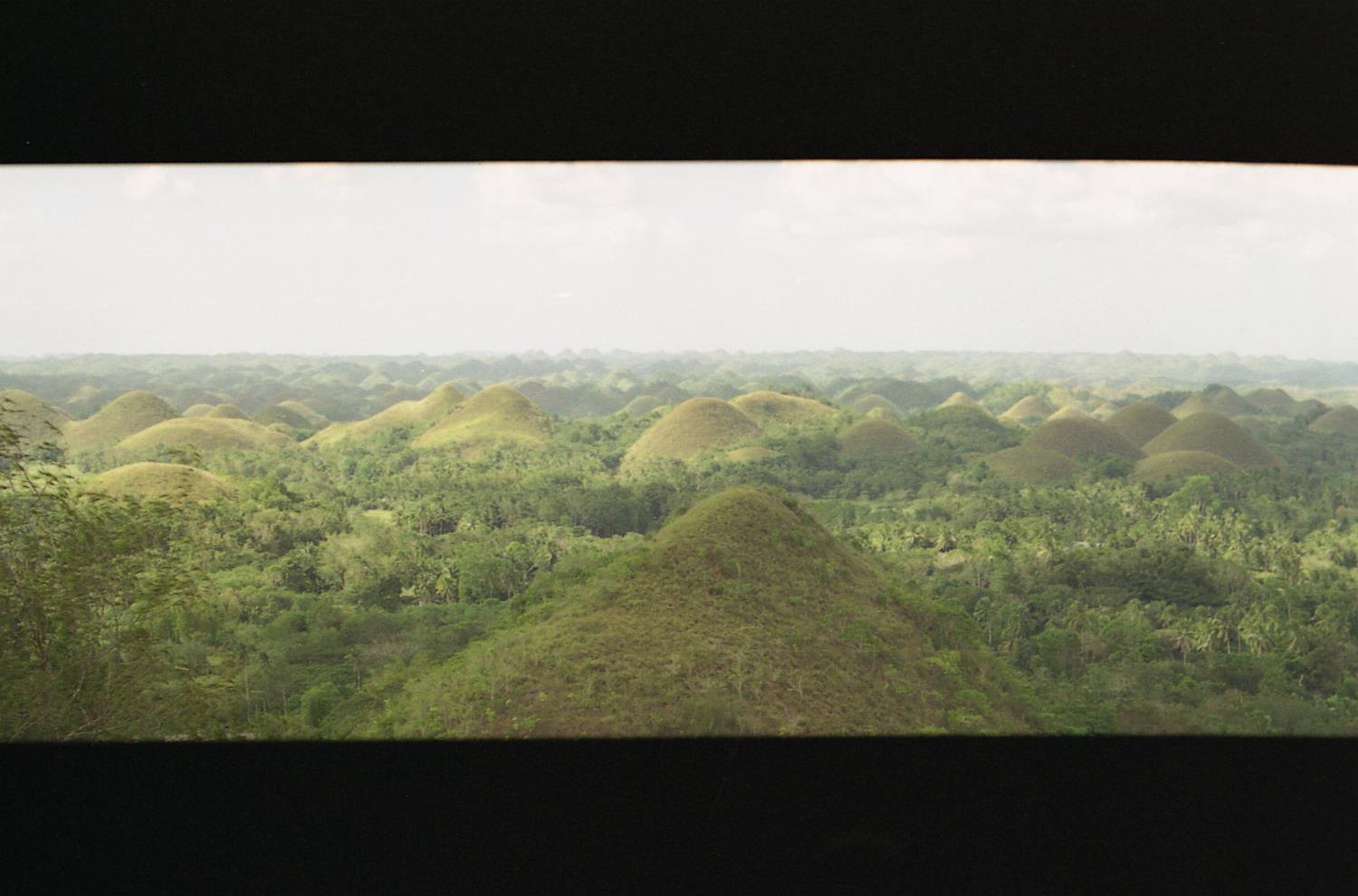 The unusual geological formation known as the Chocolate Hills in Bohol, Philippine Islands. Almost 1,300 perfectly cone-shaped hills, all about the same size, spread over some 50 square kilometers. The grass covering the hills turns brown during the dry season, giving the Chocolate Hills their name.
|
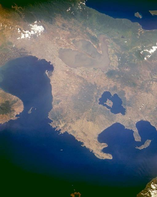 Trilobed Laguna de Bay, the largest lake in the Philippines, is visible near the upper center of this east-looking photograph of central Luzon, Philippines. The lake is more than 51 kilometers (32 miles) long and covers 891 square kilometers (344 square miles). Its outlet, the Pasig River, exits at the northwest corner of the lake, flows westward through Manila, and empties into Manila Bay. South of Laguna de Bay are the dark blue waters of Taal Lake, a filled caldera that surrounds Volcano Island. The island is home to Taal Volcano (300 meters; 948 feet high) with a crater more than 2 kilometers (1 mile) wide. The island of Corregidor, which served as the focal point in the defense of the city of Manila during World War II, is the tiny tadpole-shaped island at the entrance to Manila Bay in the center left. Photo courtesy of NASA (National Aeronautics and Space Administration of the United States).
|
| www.studenthandouts.com ↣ World Geography ↣ Asia ↣ Southeast Asia ↣ Philippines ↣ Images of the Philippines |