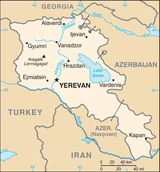
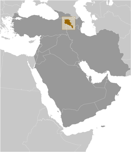
Teaching about Armenia is beneficial because it shows K-12 students how a small, landlocked country can be shaped by dramatic mountains, ancient history, and a tragic past. Armenia sits in the South Caucasus region between Europe and Asia, bordered by Turkey, Georgia, Azerbaijan, and Iran. It has no coastline, so trade depends on its neighbors. Most of the country is mountainous, with the Lesser Caucasus range covering much of the land. Mount Ararat, a national symbol, lies just across the border in Turkey.
Studying Armenia builds key geographic skills. Students can explore how high elevation creates cold winters and how snowmelt feeds rivers used for farming. They can also learn how Lake Sevan, one of the world's largest high-altitude lakes, provides water and hydroelectric power. Armenia's location has made it a crossroads for empires and trade routes for thousands of years.
The country's cultural geography is rich, with its own alphabet, ancient churches, and traditions like carpet weaving. Armenia was the first nation to adopt Christianity as a state religion, and it endured a genocide in 1915 that shaped its modern identity. For young learners, Armenia is memorable because of its mountains, monasteries, and resilient culture. Studying it builds map skills, cultural awareness, and understanding of how geography shapes a nation's history and survival.
|