 Teaching about Belarus is beneficial because it helps K-12 students understand how a landlocked country in Eastern Europe is shaped by its flat plains, dense forests, and extensive marshes. Students can explore how rivers like the Dnieper and Pripyat support transportation and farming, and how Belarus's location between Russia and Poland has influenced its trade, politics, and culture. Learning about the Pripyat Marshes, one of Europe's largest wetland areas, shows how geography affects wildlife and human settlement. For young learners, Belarus is memorable because of its forests, bison, and flat landscape. Studying it builds map skills, cultural awareness, and understanding of how geography shapes a nation's economy and identity.
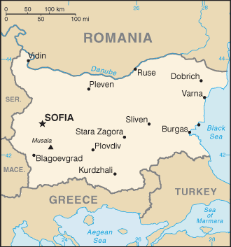
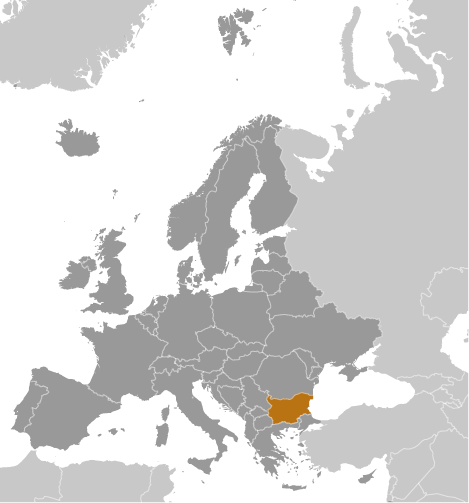
Bulgaria is a Southeast European country located on the Balkan Peninsula, bordered by Romania to the north, Serbia and North Macedonia to the west, Greece and Turkey to the south, and the Black Sea to the east. Its geography is diverse, featuring a striking combination of mountains, plains, rivers, and coastline, which contribute to the country's varied climate and natural beauty.
The northern part of Bulgaria is dominated by the Danubian Plain, a fertile agricultural area bordered by the Danube River, which forms much of the country's northern boundary. To the south of the plain lies the Balkan Mountains (Stara Planina), a major mountain range that runs west to east and divides the country. These mountains are significant both historically and geographically, serving as a natural barrier and influencing weather patterns.
Further south lies the Thracian Plain, another rich agricultural region, and beyond it, the Rhodope and Rila Mountains. The Rila range is home to Musala Peak, the highest point in Bulgaria and the Balkans at 2,925 meters. The country also contains numerous rivers, including the Maritsa and Iskar, which are essential for irrigation and hydropower.
Bulgaria's 354-kilometer Black Sea coastline provides access to maritime trade and tourism. Its geography supports a wide range of ecosystems and activities, from agriculture and industry to hiking, skiing, and seaside tourism.
|