


| Ireland Map Worksheet |
|---|
| www.studenthandouts.com ↣ World Geography ↣ Europe ↣ Northern Europe ↣ Ireland |
 |
    |
| Click here to print this map worksheet of Ireland. The answer key is below. |
|
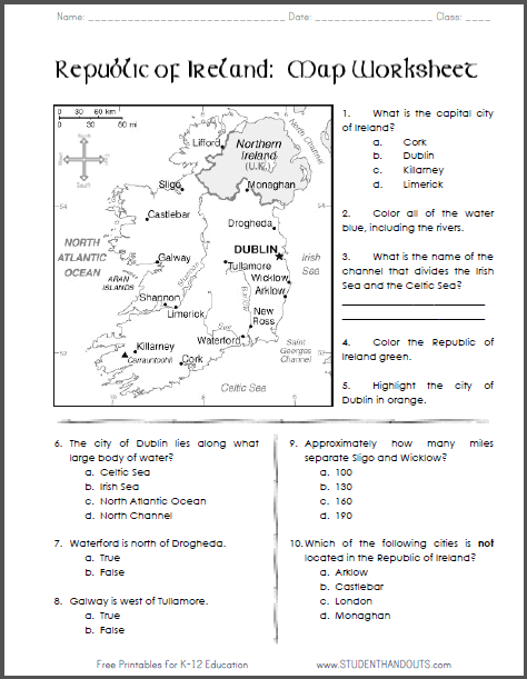
Answer Key 1. What is the capital city of Ireland? b. Dublin 2. Color all of the water blue, including the rivers. 3. What is the name of the channel that divides the Irish Sea and the Celtic Sea? St. Georges Channel 4. Color the Republic of Ireland green. 5. Highlight the city of Dublin in orange. |
6. The city of Dublin lies along what large body of water? b. Irish Sea 7. Waterford is north of Drogheda. b. False 8. Galway is west of Tullamore. a. True 9. Approximately how many miles separate Sligo and Wicklow? b. 130 10. Which of the following cities is not located in the Republic of Ireland? c. London |
| www.studenthandouts.com ↣ World Geography ↣ Europe ↣ Northern Europe ↣ Ireland |


