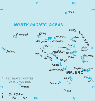
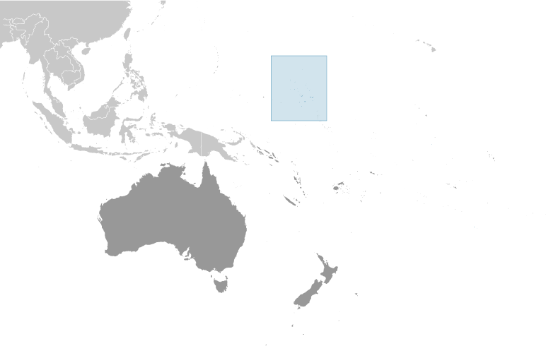
Teaching students about the geography of the Marshall Islands is an incredibly enriching experience for K-12 educators because it introduces them to a unique island country in the central Pacific Ocean. The Marshall Islands consists of 29 coral atolls and five single islands, with many smaller islands and islets spread across a large area of ocean. Its location and natural features provide exciting opportunities for students to explore how geography shapes communities, cultures, and everyday life.
One important benefit of studying the Marshall Islands is learning about coral atolls. These ring-shaped islands form around lagoons and are made from coral and other materials. Many are low-lying, which means they rise only a few feet above sea level. Students can compare these landforms with mountains, plains, and valleys found in other parts of the world. This helps them understand how natural processes shape Earth's surface and create different environments.
The country's location also makes it an excellent subject for learning map skills and ocean geography. The Marshall Islands is spread across a vast area of the Pacific, making travel between islands challenging. For generations, Marshallese navigators have used traditional knowledge of stars, ocean swells, winds, and currents to travel between islands. Learning about these skills helps students appreciate the scientific knowledge and cultural traditions that have supported island communities for centuries.
Studying the Marshall Islands also encourages environmental awareness. Rising sea levels, coastal erosion, and saltwater entering freshwater supplies threaten many communities. Students can explore how climate change affects homes, food supplies, and natural resources. They can also learn about efforts to protect coral reefs, preserve coastlines, and prepare for environmental changes. These lessons connect geography with science and responsible decision-making.
The geography of the Marshall Islands also helps students understand the relationship between people and the ocean. Fishing, transportation, and local food traditions are closely connected to the surrounding waters. Educators can use these topics to encourage respect for Marshallese culture and the knowledge passed down through generations.
Ultimately, teaching the geography of the Marshall Islands helps students develop map-reading skills, critical thinking, and global awareness. It shows them that geography is more than memorizing locations. By studying this island nation, students discover how the environment influences culture, daily life, and the challenges communities face in a changing world.
|