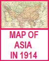
Utilizing maps and pictures is a powerful way to enhance your high school World History students' understanding of the nationalist and communist revolutions in twentieth-century China. Maps allow students to visualize key developments such as the shifting control between the Kuomintang and the Communist Party during the Chinese Civil War, the route of the Long March, and the regional influence of foreign powers in earlier decades. These visual tools help students connect geography with political and military strategy.
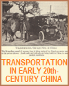
Pictures—such as photographs of revolutionary leaders, soldiers, and propaganda posters—offer vivid insights into the emotions, symbols, and social conditions of the time. Images from events like the May Fourth Movement or the Cultural Revolution make abstract political ideologies more concrete, revealing how revolution affected ordinary people.
By analyzing these visuals, your students strengthen their critical thinking and observation skills while reinforcing content learned from texts and lectures. Maps and pictures cater to visual learners and promote engagement, helping students better grasp the scale, complexity, and impact of China's twentieth-century revolutions.
|


