Maps and pictures are powerful tools for increasing comprehension among high school World History students learning about Latin America in the years following independence from Spanish rule. These visual aids help students connect abstract historical concepts to real-world geography and lived experiences, making learning more tangible and engaging.
Maps are especially useful for illustrating how Latin America changed after independence. Students can see the fragmentation of large colonial territories into newly independent nations and track territorial disputes, shifting borders, and regional conflicts. Political and physical maps also help explain how geography influenced trade, transportation, and communication, as well as the isolation of regions that contributed to political fragmentation and the rise of local strongmen, or caudillos.
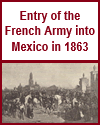
Pictures, including historical paintings, photographs, and political cartoons, give students visual context for the people, cultures, and conflicts of the time. They can examine images of leaders, battles, and everyday life to better understand the era's political and social dynamics. Visuals also highlight the diversity of Latin American societies, including indigenous and Afro-Latin communities, whose stories are often underrepresented in traditional texts.
By incorporating maps and pictures into lessons, educators can enhance engagement and deepen student understanding. These materials foster critical thinking and historical empathy, helping students better grasp Latin America's complex post-independence journey.
|