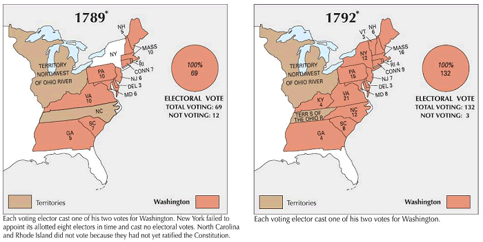
These maps illustrate voting patterns in the presidential elections of 1789 and 1792, in which George Washington was elected as president of the United States of America.
Courtesy of the U.S. National Atlas. Click here to enlarge.
The presidential elections of 1789 and 1792 were unique in American history, functioning more as acclamations than contests.
With the new Constitution in place, George Washington was the unanimous choice for the nation's first president. In both elections, he received all 69 electoral votes (1789) and all 132 electoral votes (1792).
The real uncertainty involved the vice presidency. In 1789, John Adams won the second-most votes. The 1792 election confirmed this Federalist ticket, with Adams again becoming vice president.
These non-partisan elections, conducted under the original rules where the runner-up became vice president, provided a brief, unifying start to the American presidential tradition before the rise of political parties.
|


")


