| Comoros Geography Education |
|---|
| |
 | |
 | |
 | |
 | |
| |
| |
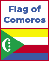
Flag of Comoros | |
Comoros Political Map | |
Comoros Global Position Map | |
Comoros Notebooking Worksheet | |
| |
| Printable Comoros Handwriting Practice Worksheets |
| Cursive | Print - Printable handwriting practice worksheet for kids featuring "Comoros" |
The Comoros is an island nation located in the Indian Ocean, off the eastern coast of Africa between Madagascar and Mozambique. It consists of three main volcanic islands—Grande Comore (Ngazidja), Anjouan (Nzwani), and Mohéli (Mwali)—as well as several smaller islets. Each island has its own unique landscape, but all are mountainous, lush, and tropical. Grande Comore, the largest island, is dominated by Mount Karthala, an active volcano that stands over 2,300 meters (7,500 feet) high. The volcanic origin of the islands contributes to their rich, fertile soil, which supports agriculture but also presents risks from eruptions and earthquakes.
The islands are surrounded by coral reefs, providing stunning marine ecosystems and protecting the coastline. The terrain is rugged in many areas, with steep slopes and limited flat land. This geography affects transportation and agriculture, with much of the population concentrated in coastal towns and valleys.
Comoros has a tropical maritime climate, characterized by warm temperatures year-round and distinct wet and dry seasons. The rainy season typically runs from November to April. The islands receive substantial rainfall, especially on windward slopes, supporting diverse vegetation and wildlife. However, the country is also vulnerable to cyclones, coastal erosion, and the environmental impacts of deforestation and population growth.
|
 |
| www.studenthandouts.com ↣ Geography ↣ Africa ↣ Geography of Eastern Africa ↣ Comoros |


