Iran Geography Education Materials | Student Handouts
 
Welcome to Student Handouts--www.studenthandouts.com! 100% free teaching materials for students in kindergarten through high school--lesson plans, worksheets, PowerPoints, outlines, interactive games, puzzles, and so much more!
 
Iran Geography Education
www.studenthandouts.com > World Geography > Asia > South-central Asia > Iran
 
 
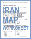
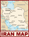
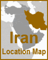
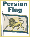
  Iran Map Worksheet   Iran Political Map   Iranian Flag   Iran Global Location Map   Flag of Persia (Modern Iran), circa 1900  
  Iran Map Worksheet   Iran Political Map   Iranian Flag   Iran Global Location Map   Flag of Persia (Modern Iran), circa 1900  
 
 
Printable Worksheets
 
Cursive | Print - Printable handwriting practice worksheet for kids featuring "Iran"
 
Cursive | Print - Printable handwriting practice worksheet for kids featuring "Tehran, Iran"
 
 
Iran is a geographically diverse country located in the Middle East, bordered by the Caspian Sea to the north and the Persian Gulf and Gulf of Oman to the south.

It is characterized by rugged mountains, vast plateaus, and desert basins.

The Zagros Mountains run along the western border, while the Alborz Mountains rise in the north, containing Iran's highest peak, Mount Damavand.

Central Iran is dominated by arid plateaus and deserts, such as the Dasht-e Kavir and Dasht-e Lut, some of the hottest places on Earth.

Despite its arid interior, Iran has fertile coastal plains in the north and southwest, supporting agriculture.

Major rivers like the Karun and Zayandeh Rud are vital for irrigation.

Iran's strategic location between Asia, the Middle East, and the Indian subcontinent has historically made it a crossroads of trade and culture.
 
 
Iran Geography Education - Free PDF printables for high school students.
 
 
www.studenthandouts.com > World Geography > Asia > South-central Asia > Iran