


| Iran Political Map Worksheet |
|---|
| www.studenthandouts.com ↣ World Geography ↣ Asia ↣ South-central Asia ↣ Iran |
 |
    |
|
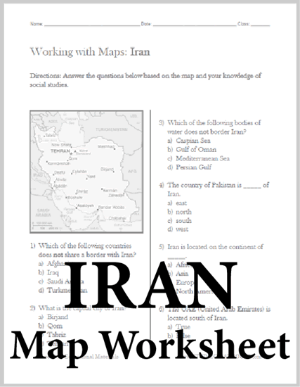
This stand-alone worksheet features a map of Iran followed by six multiple-choice questions. Our map worksheet on Iran is designed for students from upper elementary through high school. Click here to print. Click here to print the answer key. 1) Which of the following countries does not share a border with Iran? a) Afghanistan b) Iraq c) Saudi Arabia d) Turkmenistan. 2) What is the capital city of Iran? a) Birjand b) Qom c) Tabriz d) Tehran. 3) Which of the following bodies of water does not border Iran? a) Caspian Sea b) Gulf of Oman c) Mediterranean Sea d) Persian Gulf. 4) The country of Pakistan is _____ of Iran. a) east b) north c) south d) west. 5) Iran is located on the continent of _____. a) Africa b) Asia c) Europe d) North America. 6) The UAE (United Arab Emirates) is located south of Iran. a) True b) False. |
 |
| www.studenthandouts.com ↣ World Geography ↣ Asia ↣ South-central Asia ↣ Iran |


