


| Iraq Political Map Worksheet |
|---|
| www.studenthandouts.com ↣ World Geography ↣ Asia ↣ Western Asia ↣ Iraq |
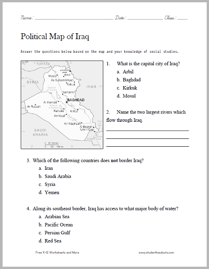
| Directions: Answer the questions below based on the map and your knowledge of social studies. |
 |
    |
|
Click here to print this worksheet.
1. What is the capital city of Iraq? (a) Arbil; (b) Baghdad; (c) Kirkuk; (d) Mosul. 2. Name the two largest rivers which flow through Iraq. Tigris and Euphrates 3. Which of the following countries does not border Iraq? (a) Iran; (b) Saudi Arabia; (c) Syria; (d) Yemen. 4. Along its southeast border, Iraq has access to what major body of water? (a) Arabian Sea; (b) Pacific Ocean; (c) Persian Gulf; (d) Red Sea. |
 |
| www.studenthandouts.com ↣ World Geography ↣ Asia ↣ Western Asia ↣ Iraq |


