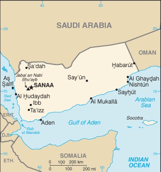
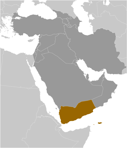
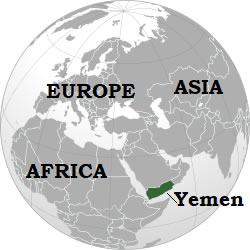
Teaching about Yemen is beneficial because it shows K-12 students how geography shapes a country's daily life, culture, and challenges. Yemen sits at the southern tip of the Arabian Peninsula in the Middle East, bordered by Saudi Arabia and Oman, with coastlines on the Red Sea and the Arabian Sea. The country's landscape includes coastal plains, high mountains, and the Rub' al Khali desert. The highlands catch seasonal rain, allowing farming of coffee, qat, and sorghum, while the coast is hot and dry.
Studying Yemen builds key geographic skills. Students can explore how mountains and deserts create different climates and where people live. They can also learn how Yemen's location made it a historic center for trade, especially coffee and frankincense, connecting it to Africa and Asia. The Socotra archipelago, part of Yemen, is famous for unique plants found nowhere else on Earth.
The country's cultural geography is rich, with ancient cities like Sana'a and Shibam, whose mud-brick towers are UNESCO World Heritage Sites. For young learners, Yemen is memorable because of its mountains, coffee history, and island biodiversity. Studying it builds map skills, cultural awareness, and understanding of how geography shapes a nation's identity and struggles in the Middle East.
|