Teaching about North Macedonia is incredibly helpful because it shows K-12 students how a small, landlocked Balkan country can be shaped by mountains, lakes, and a rich mix of cultures.
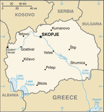
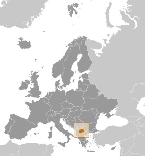
North Macedonia sits in southeastern Europe, bordered by Serbia, Kosovo, Bulgaria, Greece, and Albania. It has no coastline, so trade depends on its neighbors. The country is mostly mountainous, with the Šar Mountains in the west and the Osogovo range in the east. Deep valleys and rivers cut through the landscape, and three large lakes—Ohrid, Prespa, and Dojran—sit in the south.
Studying North Macedonia builds key geographic skills. Students can explore how tall mountains and lush valleys shape settlement, farming, and transportation. They can also learn how Lake Ohrid, one of Europe's oldest and deepest lakes, supports unique species found nowhere else. The country's rivers provide hydropower, and its valleys grow tobacco, grapes, and wheat.
The country's cultural geography is rich, blending Slavic, Albanian, Turkish, and Romani influences. Ancient sites like Ohrid's churches and Roman ruins show layers of history. For young learners, North Macedonia is memorable because of Lake Ohrid, mountains, and its complex name dispute with Greece, resolved in 2019. Studying it builds map skills, cultural awareness, and understanding of how geography shapes identity and politics in the Balkans.
|