Map of U.S. Territorial Acquisitions Since 1783 | Student Handouts
  Welcome to Student Handouts! We hope that you enjoy our thousands of free educational materials for kindergarten through high school. Utilize the navigation along the left of the page to find the grade or topic you desire.
 
Map of United States Territorial Acquisitions Since 1783
www.studenthandouts.comGeographyNorthern AmericaU.S.A. Geography
 
 
Map of United States Territorial Acquisitions Since 1783 - Free to print (PDF file).
 
 
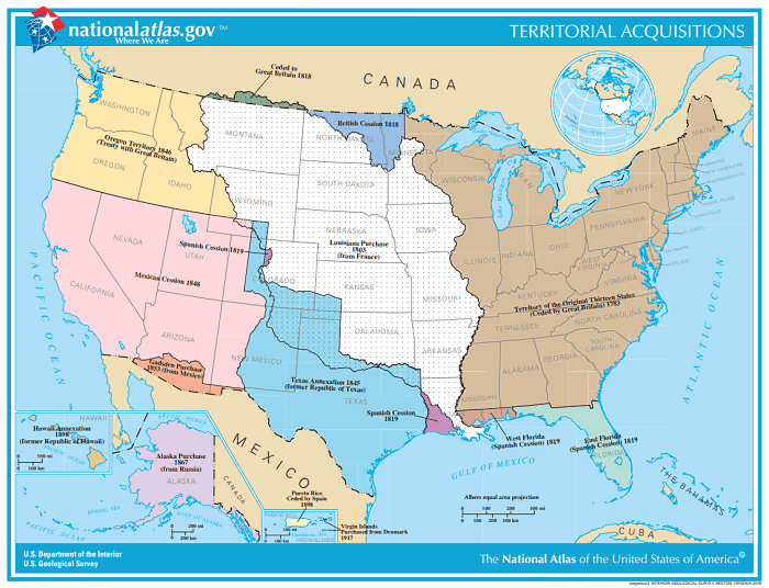
This map includes American continental (or near the continental United States) territorial acquisitions since 1783. Puerto Rico is included, but not areas such as Guam. Click here to print (PDF format). Click here to enlarge. Image courtesy of the National Atlas.
 
 
Map of United States Territorial Acquisitions Since 1783
 
 
Free K-12 Education Printables Map Eastern or Russian Front in World War I Five Parts of a Story Worksheet Country Capitals Mastermind Online Game Early U.S. Foreign Policy Writing Exercises Prominent Native American Groups of 1890
 
 
www.studenthandouts.comGeographyNorthern AmericaU.S.A. Geography