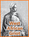
Using maps and pictures is extremely important for high school World History students studying African civilizations.
Maps help students understand the geographic context of powerful civilizations like Mali, Axum, and Great Zimbabwe—highlighting trade routes, natural resources, and regional influence.
They also show how geography shaped cultural and economic development.
Pictures of ancient cities, artifacts, art, and architecture bring history to life, allowing students to visualize the achievements and daily lives of people from these societies.
These visual tools make abstract information more concrete, support different learning styles, and deepen student engagement.
Maps and images also help dispel misconceptions by emphasizing Africa's historical richness and diversity, fostering a more accurate and respectful understanding of its civilizations.
|


