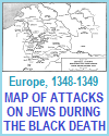
Utilizing maps and pictures is a powerful way to help your high school World History students understand the impact of the plague in medieval European history. Maps showing trade routes and the spread of the Black Death across Europe give students a clear visual of how the disease traveled from Asia via merchant ships and caravans, reaching major cities and rural areas alike. These visuals help students grasp the scale and speed of the pandemic's spread.
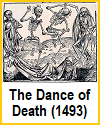
Pictures and illustrations from medieval manuscripts, including images of plague doctors, mass burials, and depictions of everyday life during the outbreak, provide a window into how people experienced and responded to the crisis. Such visuals evoke emotional responses and foster empathy, while also revealing cultural and religious attitudes of the time.
By analyzing these sources, students engage more deeply with the material, develop critical thinking skills, and better retain information. Maps and pictures make abstract or distant historical events more concrete and accessible, enhancing overall comprehension and classroom discussion.
|


