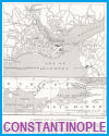
Utilizing our maps and pictures can significantly enhance your high school World History students' understanding of the Byzantine Empire by making abstract historical concepts more tangible and visually engaging. Maps allow students to trace the geographic evolution of the empire, from its foundation by Constantine to its greatest territorial extent and eventual decline. By studying trade routes, military campaigns, and shifting borders, students gain insight into the empire's strategic importance between Europe and Asia.
Pictures—such as photographs of Byzantine mosaics, architecture, icons, and artifacts—bring the culture to life. For instance, viewing images of the Hagia Sophia helps students appreciate the architectural and religious significance of the empire. Depictions of emperors, court life, and religious ceremonies offer a window into Byzantine society and values.
Visual materials support different learning styles, aid memory retention, and stimulate curiosity. They also encourage students to analyze how geography and culture influenced the Byzantine Empire's development and long-term legacy.
|


