


| Map of Europe in 1096 During the Crusades |
|---|
| www.studenthandouts.com ↣ World History ↣ Crusades ↣ Crusades Maps and Pictures |
 |
|
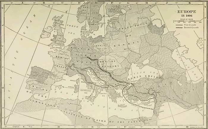
This map features the routes of the first two Crusades. Also manifest are the Empire of the Almoravids, Kingdom of Castile, Eastern Roman Empire, Seljuk Dominions, Caliphate of Cairo (of the Fatimites), Kingdom of France, Holy (Western) Roman Empire, and much more. Click here to enlarge this image. |
 | ") |  |  | ") |  |
| Crusades Books and Films | Crusades Outlines and PowerPoints |
| Crusades Maps and Pictures | Crusades Study Games |
| Crusades Miscellany | Crusades Worksheets |
| www.studenthandouts.com ↣ World History ↣ Crusades ↣ Crusades Maps and Pictures |


