Map of the British Empire in 1914 and 1920 | Student Handouts
 
Welcome to Student Handouts--www.studenthandouts.com! 100% free teaching materials for students in kindergarten through high school--lesson plans, worksheets, PowerPoints, outlines, interactive games, puzzles, and so much more!
 
Map of the British Empire in 1914 and 1920
www.studenthandouts.com > World History > Imperialism > Imperialism Maps and Pictures
 
 
British imperialism: map of the colonial empire of Great Britain in 1920, after World War I.
 
 
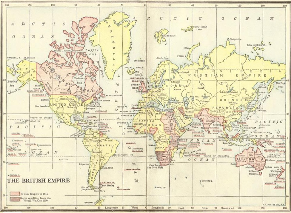
British imperialism: Map of the colonial empire of Great Britain in 1920, after World War I. Imperialism in Africa, Asia, Australia, North and Central America, and the Americas. Click here to enlarge this image.

Between 1914 and 1920, the British Empire was at its peak in global influence but also faced significant challenges. During World War I, Britain relied heavily on its colonies for troops, resources, and economic support. Soldiers from India, Africa, Canada, Australia, and other territories fought alongside British forces. After the war, Britain gained new mandates in the Middle East, such as Palestine and Iraq, expanding its reach. However, the war strained the empire economically and politically. Nationalist movements grew stronger in places like India and Ireland, demanding greater self-rule or independence. The postwar period marked the beginning of gradual imperial decline.
 
 
We recommend that educators check out these other free teaching materials our experts have created. World Landmarks Poster Project with Rubric Causes Blank Chart Worksheet "Concord Hymn" by Ralph Waldo Emerson Jean Francois Champollion Biography Workbook Franco-American Alliance Reading with Questions
 
 
Imperialism Books and FilmsImperialism Outlines and PowerPoints
  
Imperialism Maps and PicturesImperialism Study Games
  
Imperialism MiscellanyImperialism Worksheets
 
 
www.studenthandouts.com > World History > Imperialism > Imperialism Maps and Pictures