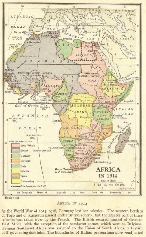
Imperialism in Africa: Map of European colonial possessions in Africa as of 1914, at the start of World War I. The possessions of Great Britain, France, Germany, Portugal, Italy, Belgium, Spain, as well as independent African states (Abyssinia/Ethiopia and Liberia).
In the war of 1914-1918 (World War I), Germany lost its colonies.
The western borders of Togo and of Kamerun (Cameroon) passed under British control, but the greater part of these colonies was taken over by the French.
The British secured control of German East Africa, with the exception of the northwest corner, which went to Belgium. German Southwest Africa was assigned to the Union of South Africa, a British self-governing dominion.
The boundaries of Italian possessions were readjusted.
Click here to enlarge.
|