


| Map of the Holy Roman Empire |
|---|
| www.studenthandouts.com ↣ World History ↣ European Middle Ages ↣ Medieval Maps and Pictures |
 |
    Map Worksheet") |
|
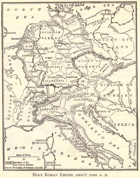
This map illustrates the Holy Roman Empire as it appeared around the year 1000 C.E. The smaller dashed line indicates the boundary of Germany in 1920, just after World War I. The empire can be seen bordered by the Duchy of Poland, the Kingdom of Hungary, the Theme of Lombardy, the Kingdom of Burgundy, and the Kingdom of France. North to south, it stretches from the North Sea and Baltic Sea to the Mediterranean and Adriatic. Click here to enlarge this image. |
| Middle Ages Books and Films | Middle Ages Outlines and PowerPoints |
| Middle Ages Maps and Pictures | Middle Ages Study Games |
| Middle Ages Miscellany | Middle Ages Printable Worksheets |
| www.studenthandouts.com ↣ World History ↣ European Middle Ages ↣ Medieval Maps and Pictures |


