 |
|---|
| Unit I: Early America Maps and Pictures |
|---|
| www.studenthandouts.com > U.S. History > Early America > Maps and Pictures |
 |  |  |  |
|||||||
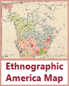
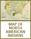
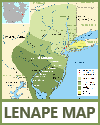
| Native American Groups | Ethnographic Map of North America | Map of North American Indian Groups | Lenape Map |
|
Our maps and pictures are powerful visual aids that can significantly enhance students' understanding of the pre-Columbian era of United States history. They provide visual context, help students visualize geographical locations, and offer insights into the cultures, landscapes, and artifacts of indigenous peoples.
Geographical Context: Maps are essential for helping students grasp the geographical diversity of the Americas before European contact. They can illustrate the locations of major indigenous civilizations, regions, and landscapes, giving students a sense of the vastness and variety of pre-Columbian America. Identification of Major Civilizations: Maps can pinpoint the locations of significant indigenous civilizations, such as the Maya, Aztec, Inca, Cahokia, and others. Students can see where these civilizations thrived and how they were distributed across the continent. Migration Patterns: Maps can depict the migration and settlement patterns of indigenous peoples. For example, maps can show the movement of early human populations across the Bering land bridge, down into North and South America, and along coastal routes. Environmental Factors: Maps can highlight environmental factors that influenced pre-Columbian cultures, such as the distribution of water sources, climate zones, and natural resources. Understanding these factors is crucial for comprehending settlement patterns and subsistence strategies. Trade Routes: Maps can illustrate trade networks and routes that connected different indigenous societies. These routes played a vital role in the exchange of goods, ideas, and cultural influences. Artistic Representations: Pictures and illustrations provide visual representations of indigenous art, architecture, and cultural practices. For example, students can see depictions of Maya pyramids, Aztec temples, and Inca terrace farming. Artifacts and Artwork: Pictures of artifacts, such as pottery, tools, and sculptures, allow students to examine the craftsmanship and artistic styles of pre-Columbian cultures. Artwork can reveal the symbolism and themes important to these societies. Lifestyle and Daily Activities: Visual representations can offer glimpses into the daily life and activities of indigenous peoples, including hunting, farming, weaving, cooking, and religious ceremonies. Students can gain insights into the practical and cultural aspects of these societies. Cultural Diversity: Pictures and illustrations can convey the rich diversity of indigenous cultures, including clothing, body adornments, and regional variations in customs and traditions. Interactions with Nature: Visuals can showcase the ways in which indigenous cultures interacted with their natural environments, such as building structures in harmony with the landscape or using natural materials for construction. Impact of European Contact: Pictures can depict the initial encounters between indigenous peoples and European explorers, shedding light on the cultural exchanges and conflicts that occurred during this period. Archaeological Discoveries: Images of archaeological sites and findings can demonstrate how researchers uncover and study pre-Columbian history. This highlights the significance of archaeological evidence in reconstructing the past. Critical Analysis: Encouraging students to critically analyze maps and pictures promotes observational skills and the ability to draw conclusions based on visual evidence. It encourages students to ask questions and think critically about historical contexts. When used in conjunction with texts, lectures, and classroom discussions, our free maps and pictures offer a multi-dimensional approach to learning about the pre-Columbian era. They engage students visually, making history more tangible and relatable, and help students develop a deeper appreciation for the richness and complexity of indigenous cultures in the Americas before European contact. |
| Early America Books and Films | Early America Image Galleries |
| Early America Learning and Study Games | Early America Miscellany |
| Early America Outlines and PowerPoints | Early America Worksheets |
| www.studenthandouts.com > U.S. History > Early America > Maps and Pictures |


