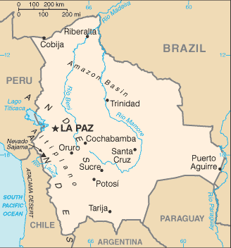
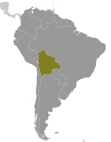
Learning about Bolivia's geography is valuable because it helps K-12 students see how extreme landscapes shape culture, economy, and daily life. Bolivia is one of only two landlocked countries in South America, a status that affects trade and national identity. It contains striking contrasts: the Altiplano highlands, where La Paz sits at roughly 11,900 feet, the expansive Salar de Uyuni salt flat, the Amazon basin, and the Andes peaks of the Cordillera Real. Lake Titicaca, shared with Peru, is the highest navigable lake in the world.
These features make Bolivia an excellent case study for geographic concepts. Students can explore how altitude influences climate, agriculture, and human health, why the country has multiple capitals and diverse Indigenous populations, and how rugged terrain complicates transportation. Bolivia's reliance on natural resources, including lithium beneath its salt flats, connects geography to global economics and environmental debates.
Bolivia also represents a cultural mosaic, with over thirty official languages and traditions rooted in Andean, Amazonian, and colonial histories. Learning about it builds empathy and global awareness while reinforcing map skills and physical geography. For young students, the country's superlatives—highest capital, largest salt flat—make lessons memorable. Understanding Bolivia helps students appreciate how place and environment influence human societies around the world.
|