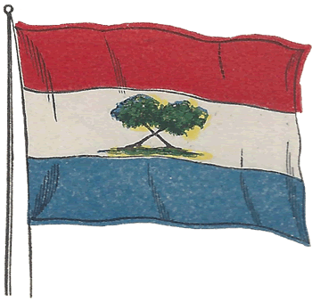
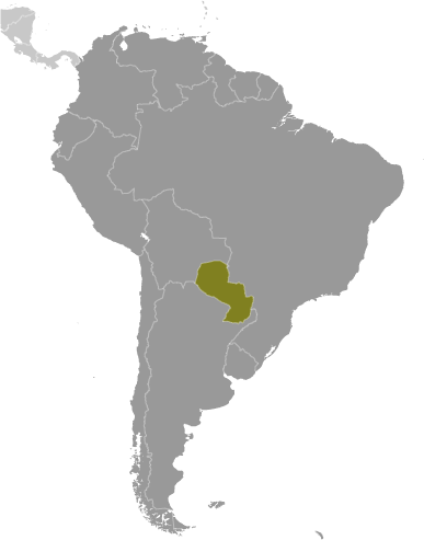
 Learning about Paraguay's geography is important because it helps your K-12 students understand how a landlocked nation can thrive through its rivers and resources. Paraguay sits at the heart of South America, bordered by Brazil, Argentina, and Bolivia, with no coastline. Yet the Paraguay and Paraná rivers form vital waterways that connect the country to the Atlantic, supporting trade and agriculture. The country divides into two distinct regions: the fertile eastern region, where most Paraguayans live, and the sparsely populated Chaco in the west, a vast dry woodland and savanna.
Studying Paraguay builds essential geographic skills. Your students can examine how rivers substitute for coastlines, how the Chaco's harsh conditions limit settlement, and how climate and soil shape economies based on soybeans, beef, and hydroelectric power. The Itaipú Dam, shared with Brazil, is one of the world's largest, making Paraguay a compelling case study in energy geography and international cooperation.
Paraguay also offers rich cultural lessons. It is bilingual, with Spanish and Guaraní spoken widely, reflecting deep Indigenous heritage. Its history includes Jesuit missions and the devastating War of the Triple Alliance, showing how geography and conflict shape national identity.
For young learners, Paraguay's contrasts—lush east versus arid Chaco, tiny riverside capital versus vast open plains—make lessons memorable. Studying Paraguay builds map skills, cultural awareness, and appreciation for how geography influences economy, energy, and identity.
|



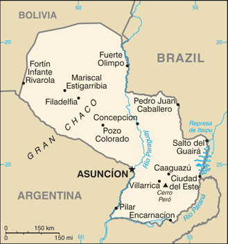
 Learning about Paraguay's geography is important because it helps your K-12 students understand how a landlocked nation can thrive through its rivers and resources. Paraguay sits at the heart of South America, bordered by Brazil, Argentina, and Bolivia, with no coastline. Yet the Paraguay and Paraná rivers form vital waterways that connect the country to the Atlantic, supporting trade and agriculture. The country divides into two distinct regions: the fertile eastern region, where most Paraguayans live, and the sparsely populated Chaco in the west, a vast dry woodland and savanna.