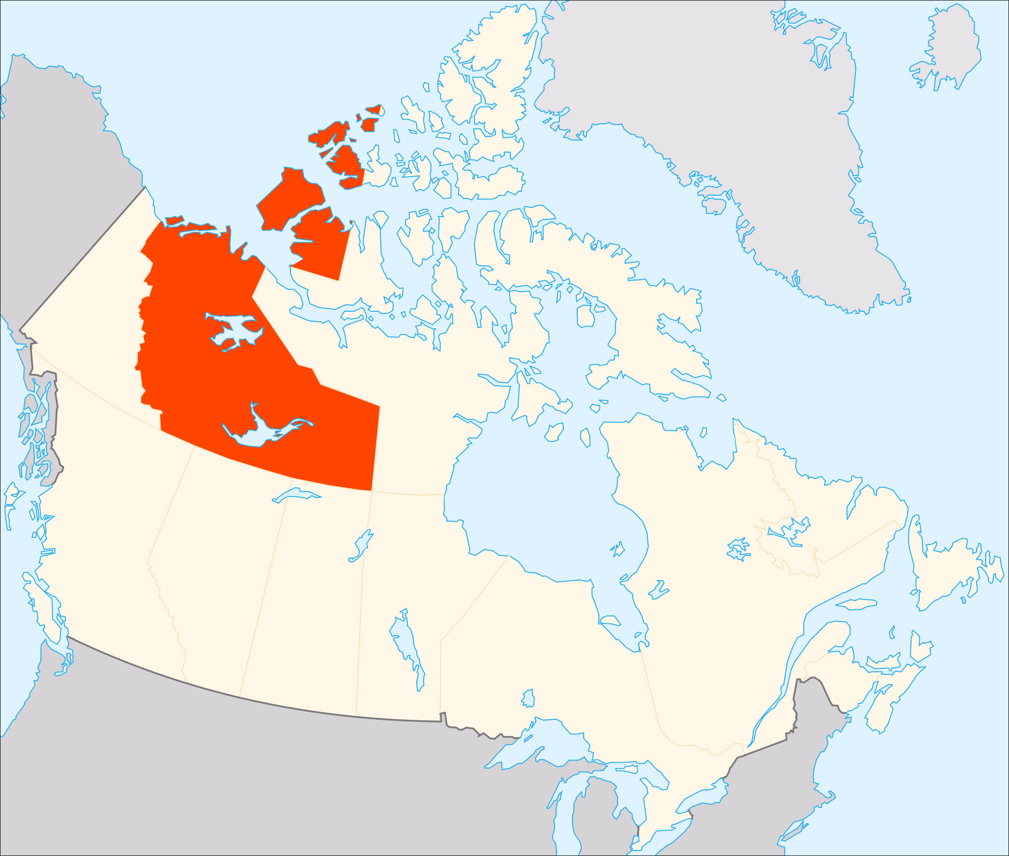
Teaching students about the geography of the Northwest Territories is an incredibly enriching experience for K-12 educators because it introduces them to one of Canada's most remarkable northern regions. Located in northwestern Canada, the Northwest Territories features vast forests, beautiful lakes, powerful rivers, mountains, and Arctic landscapes. Studying this region helps students understand how climate, landforms, wildlife, and natural resources influence people's lives and the environment.
One important benefit of learning about the Northwest Territories is exploring its physical geography. Great Bear Lake and Great Slave Lake are two of Canada's largest lakes. The Mackenzie River, one of the country's longest river systems, flows north toward the Arctic Ocean. Students can locate these features on maps and investigate how rivers and lakes provide transportation routes, support wildlife, and supply water. They can also study the region's tundra, forests, and mountains to understand how different environments support different plants and animals.
The Northwest Territories also offers valuable lessons about climate. Winters can be extremely cold, while some northern areas experience long periods of summer daylight and winter darkness. In certain places, students can observe the northern lights, a natural display of colorful light in the sky. These features provide exciting opportunities to connect geography with astronomy, weather, and Earth's movement around the Sun.
Studying this region also encourages environmental awareness. Climate change is affecting northern Canada, contributing to melting permafrost, changing wildlife habitats, and altering landscapes. Students can explore how these changes affect communities, buildings, roads, and traditional ways of life. Such lessons help them understand why environmental protection and responsible resource management matter.
The Northwest Territories is also home to Indigenous peoples, including Dene and Inuit communities. Their histories, languages, knowledge, and traditions are closely connected to the land. Educators can help students learn how hunting, fishing, travel, and community life reflect the region's geography. This approach encourages respect for Indigenous knowledge and the diversity of Canadian society.
Finally, studying the Northwest Territories strengthens map-reading skills, critical thinking, and global awareness. Students can compare this northern region with warmer places, examine settlement patterns, and explore how people adapt to challenging environments.
Ultimately, teaching the geography of the Northwest Territories helps students see that geography is more than memorizing locations. It reveals the close relationship between people and nature while encouraging curiosity, cultural understanding, and thoughtful decisions about the future of our planet.
|