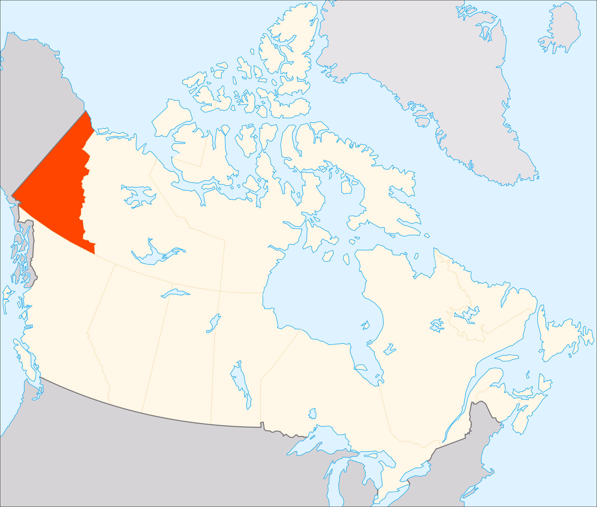
Teaching students about the geography of Yukon is an enriching way for K–12 educators to help young people understand Canada’s northern landscapes, climate, wildlife, and cultural diversity. Located in the northwest corner of Canada, Yukon borders Alaska, the Northwest Territories, and British Columbia. Its mountains, rivers, forests, and tundra offer valuable lessons about the relationship between people and their environment.
One of Yukon’s most remarkable features is its mountainous terrain. The Saint Elias Mountains include Mount Logan, the highest mountain in Canada. Kluane National Park and Reserve protects impressive peaks, glaciers, and icefields. Studying these landscapes helps students understand how glaciers shape the land, how mountains affect weather, and why some regions remain covered in ice and snow for much of the year. Maps and photographs can help students compare Yukon’s terrain with the landscapes where they live.
Yukon’s climate also provides important learning opportunities. Winters can be extremely cold, while summers bring long daylight hours. In some northern areas, the sun remains above the horizon for nearly an entire day during summer. Students can investigate how changes in daylight affect plants, animals, transportation, and daily life. They can also explore the effects of climate change on glaciers, permafrost, and northern ecosystems.
The territory’s rivers and lakes are equally important. The Yukon River flows through the territory and continues into Alaska. Historically, waterways supported travel, trade, and settlement. During the Klondike Gold Rush of the late 1890s, thousands of people traveled north hoping to find gold. This event connects physical geography with history, economics, and human migration.
Yukon is also home to diverse wildlife, including caribou, moose, bears, and Dall sheep. Its forests and tundra provide opportunities to discuss habitats, food chains, conservation, and environmental responsibility. Students can learn how people work to protect wildlife while managing natural resources.
The territory has deep connections to First Nations peoples, whose communities have lived in the region for thousands of years. Learning about their cultures, traditions, and knowledge of the land encourages respect for Indigenous history and contemporary life.
By studying Yukon, students strengthen their map-reading skills, expand their understanding of Canada, and discover how geography influences culture, history, and the environment. These lessons encourage curiosity and help students appreciate the remarkable variety of places and communities found across the world.
|