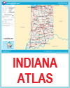
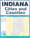
Indiana is located in the Midwestern region of the United States and features a geography that reflects the state's agricultural and industrial strengths. The state is bordered by Michigan to the north, Ohio to the east, Kentucky to the south, and Illinois to the west. To the northwest, Indiana has a short but important shoreline along Lake Michigan, which provides access to shipping routes and supports industrial activity in cities like Gary and Hammond.
 The northern and central parts of Indiana are largely flat or gently rolling, covered by fertile plains that were shaped by glaciers during the last Ice Age. These areas are ideal for farming and support the state’s strong agricultural sector, especially corn and soybean production. Central Indiana is home to the state capital, Indianapolis, a major hub for transportation and commerce. The northern and central parts of Indiana are largely flat or gently rolling, covered by fertile plains that were shaped by glaciers during the last Ice Age. These areas are ideal for farming and support the state’s strong agricultural sector, especially corn and soybean production. Central Indiana is home to the state capital, Indianapolis, a major hub for transportation and commerce.
In southern Indiana, the terrain becomes more varied, with hills, forests, and river valleys, especially near the Ohio River. The southern region includes parts of the Hoosier National Forest and features limestone deposits, which have supported a quarrying industry for over a century.
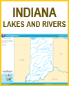
Indiana's many rivers, including the Wabash and White Rivers, have historically supported transportation, trade, and settlement. The state’s geography has played a key role in its development as both a farming and manufacturing center.
|


 The northern and central parts of Indiana are largely flat or gently rolling, covered by fertile plains that were shaped by glaciers during the last Ice Age. These areas are ideal for farming and support the state’s strong agricultural sector, especially corn and soybean production. Central Indiana is home to the state capital, Indianapolis, a major hub for transportation and commerce.


