American Midwest Geography Educational Resources | Student Handouts

American Midwest Geography Educational Resources
www.studenthandouts.com ↣ Geography ↣ Northern America ↣ U.S.A. ↣ American Midwest Geography Education


Teaching the geography of the American Midwest helps students understand farming, industry, waterways, weather patterns, and regional cultures while strengthening map skills and appreciating how geography shapes everyday life.


  Illinois Geography Educational Resources  Indiana Geography Educational Resources  Iowa Geography Educational Resources  Kansas Geography Educational Resources  Michigan Geography Educational Resources 
  Illinois  Indiana  Iowa  Kansas  Michigan 


  Minnesota Geography Educational Resources  Missouri Geography Educational Resources  Nebraska Geography Educational Resources  North Dakota Geography Educational Resources  Ohio Geography Educational Resources 
  Minnesota  Missouri  Nebraska  North Dakota  Ohio 


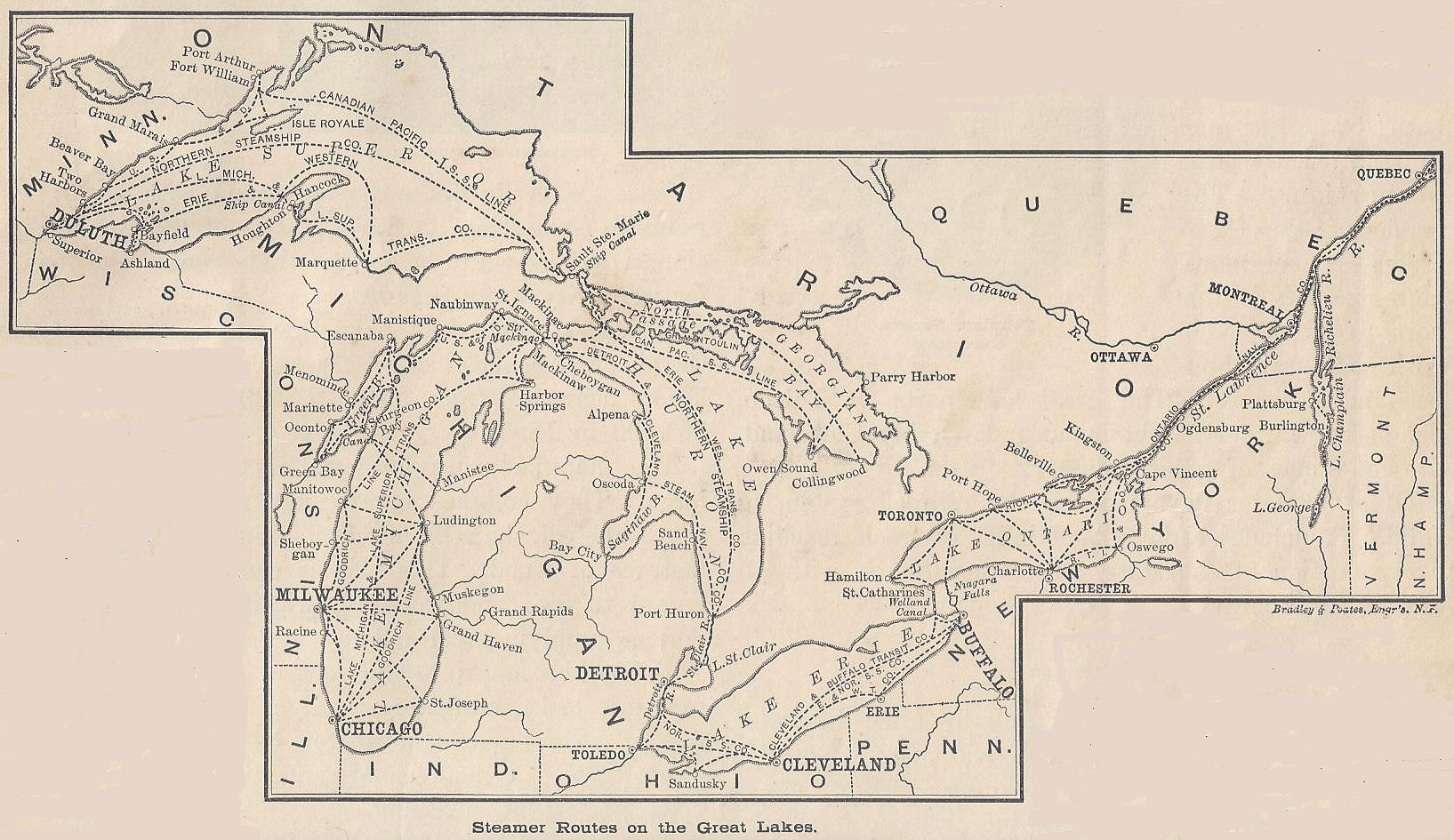
  South Dakota Geography Educational Resources  Wisconsin Geography Educational Resources  Name the Midwestern State Online Map Quiz  In Other Words Midwest Map Identify Game  1895 Steamer Routes on the Great Lakes 
  South Dakota  Wisconsin  Name the State Online Map Quiz  In Other Words Midwest Map Identify Game  Map of Steamer (Steam Ship) Routes on the Great Lakes in 1895 


The stunning topography of the American Midwest is largely defined by its broad plains, rolling hills, fertile valleys, and expansive farmland. Spanning states such as Ohio, Indiana, Illinois, Iowa, Missouri, Kansas, Nebraska, Minnesota, Wisconsin, and the Dakotas, the Midwest is often referred to as "America's Heartland" for its central location and agricultural productivity.

The region is dominated by flat to gently rolling terrain, especially in states like Illinois, Iowa, and Indiana, where rich, deep topsoil supports extensive crop farming. These areas are part of the larger Central Lowlands, shaped by ancient glaciers that left behind fertile glacial deposits. In contrast, parts of the Midwest, such as the Ozark Plateau in southern Missouri and northern Arkansas, feature more rugged hills and rocky outcrops.

To the west, the landscape transitions into the Great Plains, especially in Kansas, Nebraska, and the Dakotas, where the land becomes flatter and drier. River systems like the Mississippi, Missouri, and Ohio Rivers cut through the region, creating valleys and providing essential water sources for agriculture and transportation.

Four of the five Great Lakes—Superior, Michigan, Huron, and Erie—define the northern boundary of the Midwest, influencing climate, commerce, and settlement. Overall, the Midwest's topography has made it ideal for agriculture, while also supporting a diverse economy and widespread rural and urban development.


www.studenthandouts.com ↣ Geography ↣ Northern America ↣ U.S.A. ↣ American Midwest Geography Education


Free Printable Brain Teaser and Head Scratcher Worksheets for Kids and AdultsFree Printable Holiday Worksheets


100% Free Handwriting Practice Printables - Print and Cursive