Teaching pupils about the geography of Maryland is a valuable way for K-12 educators to connect geography with history, science, economics, and environmental studies. Although Maryland is a relatively small state, it has a wide variety of landscapes, including coastal wetlands, sandy beaches, forests, rolling hills, and mountains. Studying these features helps students understand how geography influences communities, industries, and everyday life.
 Maryland's location along the beautiful Chesapeake Bay makes it especially interesting to study. The bay is one of the largest estuaries in the United States, where freshwater from rivers mixes with saltwater from the Atlantic Ocean. Its waters support crabs, oysters, fish, and many other forms of wildlife. The bay also provides opportunities to explore fishing, boating, shipping, and environmental protection. Students in K-12 can learn how pollution, changing water conditions, and habitat loss affect this important ecosystem.
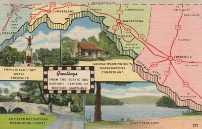
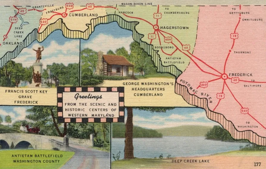
Maryland's geography also includes the Atlantic coastline, the Piedmont region, and the Appalachian Mountains in the west. These different landscapes influence local weather, wildlife, farming, and recreation. Students can compare the coastal areas with the mountainous western region to understand how landforms affect where people live and how they travel. The state experiences four seasons, offering opportunities to study temperature, rainfall, storms, and seasonal changes.
Geography plays an important role in Maryland's economy. Seafood harvesting, agriculture, manufacturing, tourism, and transportation provide jobs throughout the state. Farmers grow corn, soybeans, and other crops, while coastal communities depend partly on fishing and tourism. Baltimore's major port connects Maryland to national and international trade. The state's location near Washington, D.C., also supports government-related work and other industries.
Maryland's geography is closely connected to its history. Indigenous peoples, including the Piscataway and other Native nations, lived in the region long before European settlement. Later, waterways helped settlers establish trading communities and farms. Maryland became the seventh state in 1788.
By studying Maryland, students strengthen map-reading skills, develop environmental awareness, and discover how geography shapes history, culture, and economic activity. These lessons help young people better understand the connections between people and their environment.
|



 Maryland's location along the beautiful Chesapeake Bay makes it especially interesting to study. The bay is one of the largest estuaries in the United States, where freshwater from rivers mixes with saltwater from the Atlantic Ocean. Its waters support crabs, oysters, fish, and many other forms of wildlife. The bay also provides opportunities to explore fishing, boating, shipping, and environmental protection. Students in K-12 can learn how pollution, changing water conditions, and habitat loss affect this important ecosystem.