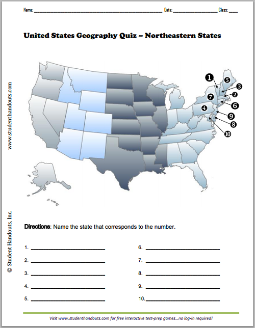
On this free printable map worksheet, students are asked to identify ten northeastern states.
Click here to print this worksheet. Click here for the answer key.
The ability to identify the ten northeastern states fosters both geographic literacy and civic understanding. This crucial foundational knowledge connects your students to a region dense with American history, from the founding colonies to the Industrial Revolution. It provides crucial context for historical events, cultural movements, and economic patterns.
Furthermore, recognizing these states—often small but populous—enhances your pupils' comprehension of modern political representation, electoral maps, and regional issues.
Ultimately, this skill grounds abstract lessons in a tangible place, enabling your students to better analyze news, history, and literature that reference this influential part of the United States of America.
|