


| Washington, D.C., Map Worksheet for Lower Elementary |
|---|
| www.studenthandouts.com ↣ Geography ↣ Northern America ↣ U.S.A. ↣ U.S. Northeast ↣ Washington, D.C. |
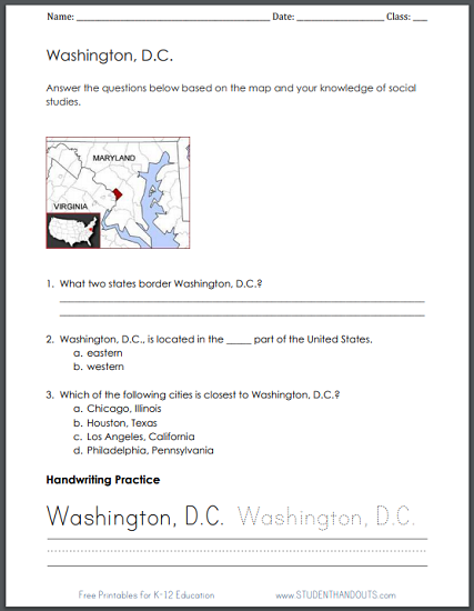
| This free printable map worksheet is designed for students in grades 1-3. The first two questions can be answered by looking at the map. The third question requires either sufficient background knowledge, or the use of a United States map. The questions are followed up with handwriting practice (which helps with spelling skills as much as with handwriting). |
 |
    |
|
Click here to print.
Answer Key 1. What two states border Washington, D.C.? Maryland and Virginia 2. Washington, D.C., is located in the _____ part of the United States. a. eastern b. western 3. Which of the following cities is closest to Washington, D.C.? a. Chicago, Illinois b. Houston, Texas c. Los Angeles, California d. Philadelphia, Pennsylvania |
| www.studenthandouts.com ↣ Geography ↣ Northern America ↣ U.S.A. ↣ U.S. Northeast ↣ Washington, D.C. |


