

| Arizona Facts Research Worksheet |
|---|
| www.studenthandouts.com ↣ Geography ↣ Northern America ↣ U.S.A. ↣ U.S. West ↣ Arizona Geography Education |
 |
    |
|
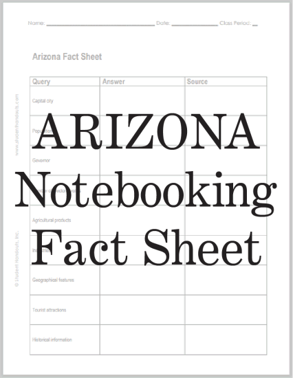
This free printable worksheet engages students in independent research on the state of Arizona. While citing their sources, students are asked to list the state's capital city, population, governor, number of electoral votes, and more. Click here to print. Students' answers will vary. Arizona's land is full of contrasts. The northern part sits on the Colorado Plateau, a high area with pine forests and the Grand Canyon, which is 277 miles long and a mile deep. The southern and central areas are lower desert, with hot, dry valleys and mountain ranges in between. Because of this, weather changes a lot—Flagstaff gets about 81 inches of snow a year, while Phoenix gets none. Arizona's economy has long relied on the "Five Cs": copper, cotton, cattle, citrus, and climate. Copper is huge—Arizona produces more copper than all the other states combined. Farming is also important. In winter, Yuma County grows most of the leafy greens eaten in the U.S. Cattle ranching and dairy are the largest agricultural sectors. Historically, Native American tribes lived in the region for thousands of years before explorers arrived. Arizona became a territory in 1863 and the 48th state on February 14, 1912. |
| www.studenthandouts.com ↣ Geography ↣ Northern America ↣ U.S.A. ↣ U.S. West ↣ Arizona Geography Education |