


| End of Direct Imperialism Chart |
|---|
| www.studenthandouts.com ↣ World History ↣ Collapse of Imperialism ↣ Collapse of Imperialism Maps & Pictures |
 |
|
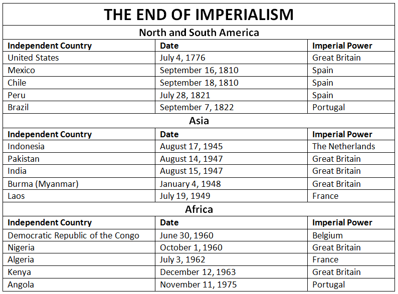
This table chart illustrates when imperialism ended in some of the major countries of North America, South America, Africa, and Asia. Countries include the United States, Mexico, Chile, Peru, Brazil, Indonesia, Pakistan, India, Burma (Myanmar), Laos, the Democratic Republic of the Congo, Nigeria, Algeria, Kenya, and Angola. The major eras for the end of imperial rule are the turn of the 19th century in the Americas, shortly after World War II in Asia, and the 1960s/1970s in Africa. |
 |  |  Biography Workbook") |  |  |  |
| www.studenthandouts.com ↣ World History ↣ Collapse of Imperialism ↣ Collapse of Imperialism Maps & Pictures |


