


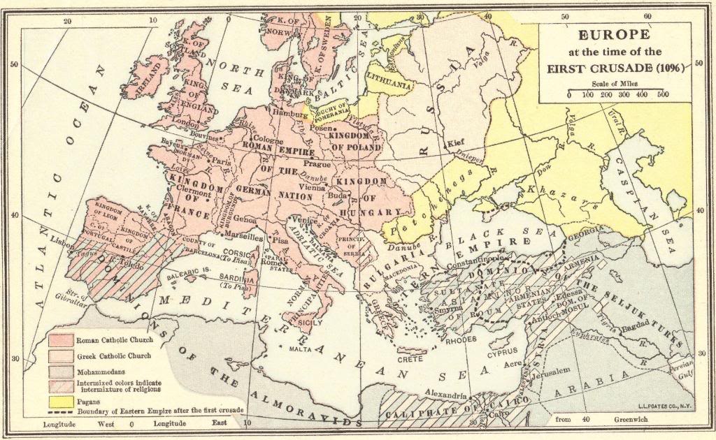
| Map of Europe at the Time of the First Crusade (1096) |
|---|
| www.studenthandouts.com ↣ World History ↣ Crusades ↣ Crusades Maps and Pictures |
 |
|
Map of Europe at the time of the First Crusade (1096). Colors indicate lands populated by followers of Catholicism, Eastern Orthodoxy, Islam, paganism, and mixed religious groups. Note that large areas of Eurasia had not yet been converted to one of today's major religions. Click here to enlarge. |
 |  |  |  | ") |  |
| Crusades Books and Films | Crusades Outlines and PowerPoints |
| Crusades Maps and Pictures | Crusades Study Games |
| Crusades Miscellany | Crusades Worksheets |
| www.studenthandouts.com ↣ World History ↣ Crusades ↣ Crusades Maps and Pictures |


