Map of England in the Civil War (1642) | Student Handouts
 
Welcome to Student Handouts--www.studenthandouts.com! 100% free teaching materials for students in kindergarten through high school--lesson plans, worksheets, PowerPoints, outlines, interactive games, puzzles, and so much more!
 
England in the Civil War (1642)
World History > Growth of English Parliamentary Democracy > English Democracy Maps & Pictures
 
 
Map of England in the English Civil War (1642)
 
 
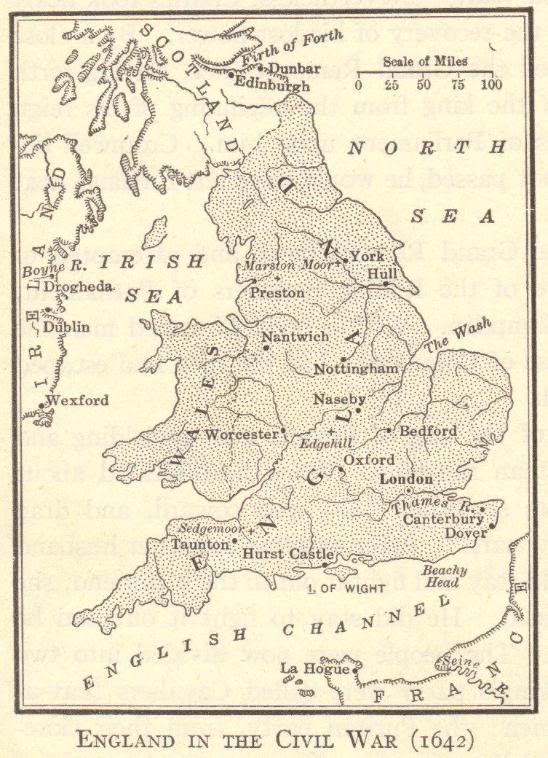
Map of England during the English Civil War in 1642. Then, as now, London was England's leading and capital city. London is located along the River Thames. England is bordered by the North Sea, the English Channel, the Irish Sea, Scotland, and Wales. The sites of important battles are marked on the map with crosses (such as Sedgemoor, Moor, and Edgehill).

The Battle of Sedgemoor, fought on July 6, 1685, was the final battle of the Monmouth Rebellion in England. It took place in Somerset and ended with the defeat of the Duke of Monmouth's rebel forces by King James II's royal army. This marked the last major battle fought on English soil. The aftermath included harsh reprisals, known as the "Bloody Assizes," led by Judge Jeffreys.
 
 
We recommend that educators check out these other free teaching materials our experts have created. The Dance of Death (1493) How to Calculate Grades Battle of Trafalgar, 1805 Holy Roman Emperor Charles V of Spain (1500-1558) World War I in World History Pictures and Maps
 
 
English Democracy Books and Films English Democracy Outlines and PowerPoints
   
English Democracy Maps and Pictures English Democracy Study Games
   
English Democracy Miscellany English Democracy Worksheets
 
 
World History > Growth of English Parliamentary Democracy > English Democracy Maps & Pictures