World War I Maps and Pictures | Student Handouts
 
Welcome to Student Handouts--www.studenthandouts.com! 100% free teaching materials for students in kindergarten through high school--lesson plans, worksheets, PowerPoints, outlines, interactive games, puzzles, and so much more!
 
History of the World: Free Worksheets, PowerPoints, Practice Tests, and More, for K-12 World History, European History, and Global Studies
 
World War I Maps and Pictures
 
 
For more of our free educational materials on World War I, click here.
 
 
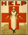
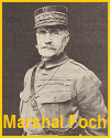
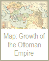
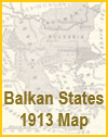
  Souter Red Cross Nurse Poster World War I   Marshal Ferdinand Foch (1851-1929)   Map of the Growth of the Ottoman Turkish Empire, 1355-1683   Map of the Balkan states at the end of 1913.  Europe.    
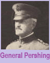
  Red Cross Nurse Poster   Marshal Foch   Ottoman Turkish Empire   Balkan States, 1913   General Pershing  
 
 
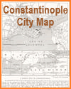
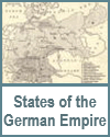
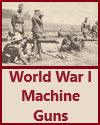
  Its situation at the cross-roads between the East and West has caused Constantinople's history to be written in blood. While Great Britain, France, and Italy have decided to restore the Turks to full authority in the city and to the Asiatic side of the Dardanelles, provision is made for a broad demilitarized zone and an Allied force is to remain in occupation of the Gallipoli Peninsula to safeguard the free and unimpeded entrance to the Straits. The navigation of the Straits is to be placed under the control of an International Commission under a Turkish president.   Map of the states of the German empire.  Prussia, Bavaria, Saxony, Wurttemberg, Baden, Hesse, Mecklenburg-Schwerin, Anhalt, Waldeck, Lippe, Hamburg, Bremen, Lubeck, Brunswick, Saxe-Weimar, Mecklenburg-Strelitz, Saxe-Meiningen, Saxe-Coburg-Gotha, Saxe-Altenburg, Schwarzburg-Rudolstadt, Schwarzburg-Sondershausen, Reuss-Elder Branch, Reuss-Younger Branch, Schaumburg-Lippe, and Oldenburg.   Map of the decline of Turkish power in Africa, Asia, and Europe, from 1815 to 1912.   Map of the decline of Turkish power from 1815 to 1912.   Machine guns in World War I.  
  Constantinople   German Empire    Turkish Power in Africa   Decline of Turkish Power   Machine Guns  
 
 
  Trench warfare in France.   Long-range German howitzer.  At the outbreak of the World War, Germany and Austria were provided with many large-caliber guns more effective than any before used.   Refugee Camp in Istanbul (1922)   Landing American troops and supplies in France.   Map Eastern or Russian Front in World War I  
  Trench Warfare   Long-range German Howitzer   Refugee Camp in Istanbul (1922)   Landing U.S. Troops and Supplies in France   Eastern or Russian Front  
 
 
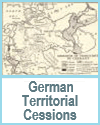
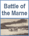
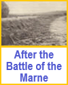
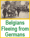
  Map of lands ceded by the treaty of 1919 with Germany.  Cessions of territory by Germany: to France, Belgium, Poland, Czechoslovakia, Lithuania, Denmark; parts controlled by the League of Nations; as of 1922.   After the Battle of the Marne   Battle of the Marne, 1914   Hanging railway between Barmen and Elberfeld, Germany.  This suspended trolley line is built over the bed of the River Wupper and connects two neighboring cities in one of the most important manufacturing centers of Germany.  The rapid industrial and commercial development of Germany had a significant bearing on its domestic and foreign policies before the World War.    
  German Territorial Cessions   After the Battle of the Marne   Battle of the Marne   Hanging Railway   Belgians Fleeing  
 
 
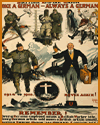
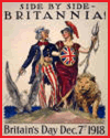
  Soaking flax on a Belgian farm.   British Empire Union Poster   World War I.  American airplanes maneuvering.   Side by side - Britannia! Britain's Day Dec. 7th 1918 World War I Poster   Cooking and Washing in a Refugee Camp  
  Belgian Farm   British Empire Union Poster   American Airplanes   Britain's Day, Dec. 7, 1918   Cooking and Washing in a Refugee Camp  
 
 
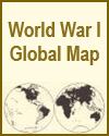
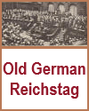
  World War I Global Map   A tank in action.  Infantrymen are advancing up hill, behind the tank.  The tank is propelled and steered by two caterpillar treads moved like belts, an American invention.  The caterpillar treads were invented by James B. Hill (of Ohio and Louisiana), who referred to the contraption as "apron traction" (originally designed as part of the Buckeye Traction Ditcher).   Sectional view of a German submarine (U-boat).   German Reichstag   After the Battle of Verdun, 1916.  French naval guns taken by the Germans and later retaken by the French.  
  World War I Global Map   WWI Army Tank   German U-Boat   German Reichstag   Battle of Verdun  
 
 
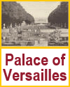
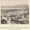
  Map of the western front in World War I.   Palace of Versailles as seen from the gardens.  This side of the palace is almost 2000 feet long.  The portion seen in this picture contains the Gallery of Mirrors, so named from the seventeen large mirrors which occupy the side of the room opposite the round arched windows on the second floor.  It was in this great hall that the Treaty of 1919 with Germany, ending the World War, was signed by delegates representing nearly nine-tenths of the population of the globe.   Beginning of reconstruction in a Belgian village.  The little restaurant has been built in the midst of the ruins of war.  The French sign above the door, À la Tête d'Or, means "The Gold Head."  The same words in the Flemish language appear in the sign on the end of the roof, In het Gouden Hoofd.  Belgium, it will be remembered, is a bilingual country.  At the street corner is a half-obliterated sign in German, a reminder of the recent enemy occupation.   City and harbor of Fiume.  Situated on an inlet of the Adriatic Sea, the city has several harbors and extensive docks, with an important railway extending eastward.  Before the World War the exports of grain, flour, sugar, lumber, and horses from Fiume amounted in value to about $30,000,000 a year.  (Croatia: Free Sstate of Fiume or Rijeka, which existed between 1920 and 1924, photographed following World War I.)    
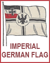
  Western Front   Palace of Versailles   Reconstruction in Belgium   Fiume or Rijeka   German Flag, circa 1900  
 
 
  Czechoslovakian Parliament in Prague   A British dreadnaught.  This type of battleship is designed to carry the largest guns and is protected by very heavy steel plates sheathing the sides and deck.   Chamber of Deputies, Paris, France.  The original building, begun in 1722, was a palace.  It was enlarged at various times and declared national property during the French Revolution.  The side facing the river, shown here, was built in 1804 and 1807, in the style of a Greek temple.   Romanian Church   Devastated Village near Belleau Wood  
  Czechoslovakian Parliament in Prague   British Dreadnought   Paris Chamber of Deputies   Romanian Church   Devastated Village near Belleau Wood  
 
 
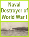
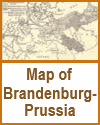
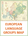
  Street festival in Bucharest, the capital of Roumania (Romania).  From an official Red Cross photograph.  The dancers are wearing, in honor of the occasion, the old national costume, preserved unchanged for generations.   Map of Brandenburg-Prussia   Map of European Language Groups   A naval destroyer, World War I.      
  Bucharest Street Festival   Brandenburg-Prussia   Map of European Language Groups   Naval Destroyer      


World War I Books and Films World War I Outlines and Powerpoints
   
World War I Online Study Games World War I Maps and Pictures
   
World War I Miscellany World War I Worksheets