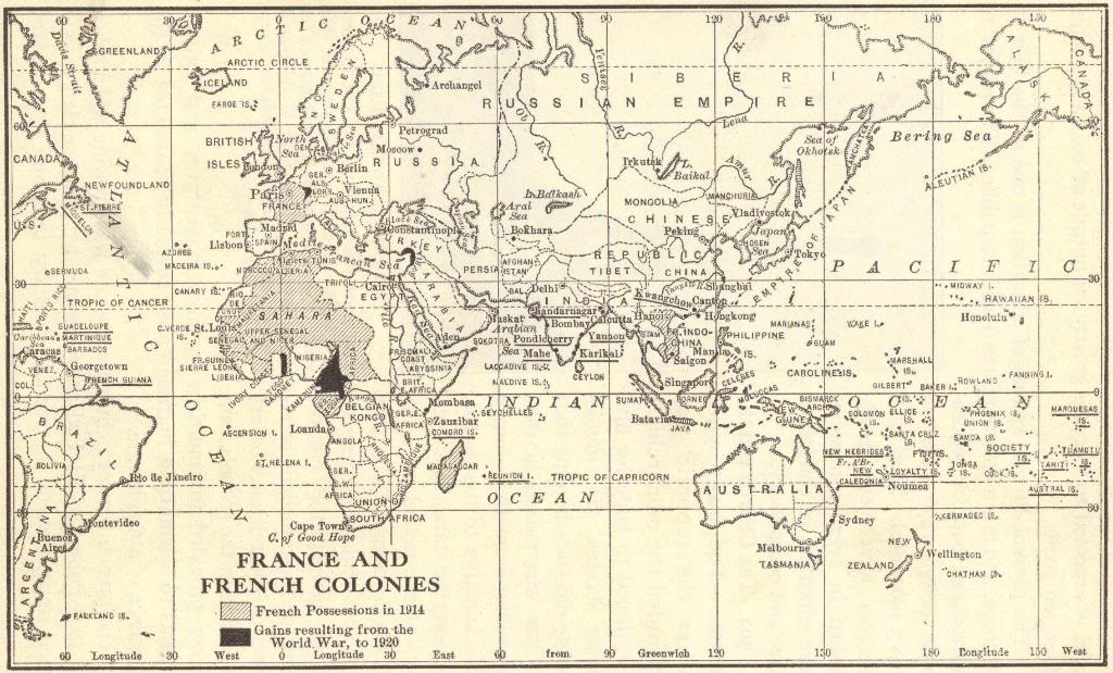
The Imperial Empire of France: Map of French colonial possessions before and after World War I. Main points of historical interest are Indochine (French Indochina or Vietnam) and large portions of Africa. There are also notable possessions in the Caribbean.
Note that St. Pierre and Miquelon, just off the coast of eastern Canada, are still part of France.
Click here to enlarge.
In the decades before World War I, the French Empire expanded significantly, becoming the second-largest colonial empire after Britain. Much of this expansion occurred in Africa, where France controlled vast territories in West and North Africa, including Algeria, Senegal, and modern-day Mali and Chad.
In Asia, France held control over French Indochina, which included Vietnam, Laos, and Cambodia. French colonial policy aimed to spread French culture, language, and political systems, often through assimilation.
These colonies provided raw materials, labor, and markets for French industries. While the empire strengthened France's global presence, it also faced resistance and unrest in many colonized regions. By 1914, colonial tensions and competition with other European powers contributed to the broader geopolitical climate leading to World War I.
|