


| Map of England in 1066 C.E. |
|---|
| www.studenthandouts.com ↣ World History ↣ European Middle Ages ↣ Medieval Maps & Pictures |
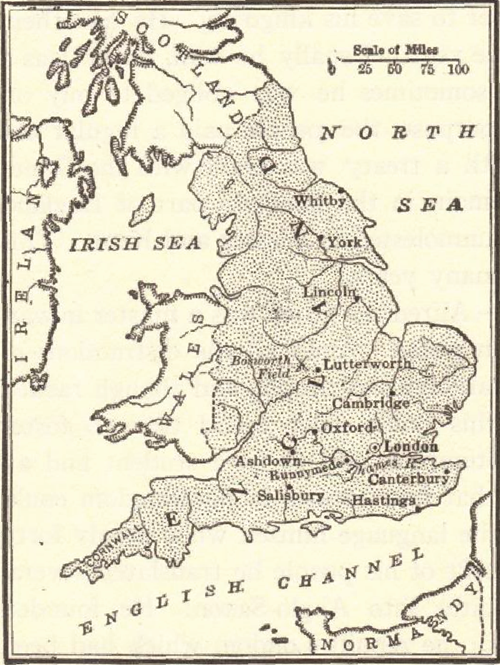 Map of England after the Norman Conquest of 1066.
 In 1066, William of Normandy—the future William I of England—crossed the English Channel and took the throne. Click here to enlarge. In 1066, England underwent a dramatic transformation following the Norman Conquest. After defeating King Harold II at the Battle of Hastings, William of Normandy became William the Conqueror and was crowned King of England. The conquest marked the end of Anglo-Saxon rule and the beginning of Norman dominance. Norman lords replaced much of the existing Anglo-Saxon nobility, and French became the language of the court, law, and high society. The Normans introduced new systems of governance, including feudalism, which restructured land ownership and loyalty. Castles, such as the Tower of London, were built to assert Norman authority and defend against rebellion. The Domesday Book, a detailed survey of land and property, was compiled in 1086 to manage taxation and control. The conquest reshaped English culture, language, and governance, leaving a lasting impact on the nation's identity and legal traditions. |
 |  |  |  |  |
| Middle Ages Books and Films | Middle Ages Outlines and PowerPoints |
| Middle Ages Maps and Pictures | Middle Ages Study Games |
| Middle Ages Miscellany | Middle Ages Printable Worksheets |
| www.studenthandouts.com ↣ World History ↣ European Middle Ages ↣ Medieval Maps & Pictures |


