Maps and pictures are powerful tools for helping high school World History students understand the complex events of the Revolutions of 1848. Maps allow students to visualize where uprisings occurred across Europe—from France and the German states to Austria and Italy—highlighting how widespread the desire for change was. They can also illustrate shifting political boundaries, centers of revolt, and the influence of nationalism, helping students see the geographic and political diversity of the revolutionary movements.
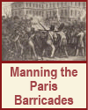
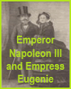
Pictures, including paintings, political cartoons, and photographs from the time, bring the revolutions to life by showing what participants and observers experienced. Images of barricades, demonstrations, and revolutionary leaders provide valuable visual context and spark deeper discussions about the emotions, challenges, and goals of the people involved.
By analyzing maps and visuals, students engage more actively with historical content, gain insight into different perspectives, and make connections between geography, ideology, and action. These materials support visual learners and make abstract historical themes—such as liberalism, nationalism, and social unrest—more concrete and memorable.
|


