


| Republic of Ireland Geography Education |
|---|
| www.studenthandouts.com ↣ World Geography ↣ Europe ↣ Northern Europe ↣ Ireland Geography Education |
| In terms of physical geography, Ireland—the "Emerald Isle"—encompasses the entire island of Ireland, located between the Atlantic Ocean and the Irish Sea. Politically, the northeastern corner of the island (referred to as Northern Ireland) is part of the United Kingdom. |
| Capital: Dublin (Republic of Ireland) and Belfast (leading city in Northern Ireland) or London (capital city of the United Kingdom) |
| Population: Circa 4.2 million in the Irish Republic (as of 2011) |
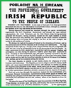 |  |  |  |  | ||||||
| DBQ on Irish Proclamation (1916) of Independence | St. Patrick's Day Holiday Worksheets and Activities | Ireland Map Worksheet | Irish Cities in ABC Order Worksheet | Ireland Word Search Puzzle |
 |  |  |  | |||||||
| Saint Patrick Biography Workbook | Irish-themed Handwriting Practice Worksheets | Irish Proverb | Ireland Image Gallery |
| Interesting Facts |
| St. Patrick is the patron saint of Ireland, and his feast day is March 17. |
| More than 40,000,000 Americans claim Irish descent. |
| More than 87% of the Irish population is Roman Catholic. |
| Ireland is only slightly larger than West Virginia. |
| The Republic of Ireland's government is a parliamentary democracy known as the Oireachtas. The Senate is called the Seanad Eireann, and the House of Representatives is called the Dail Eireann. |
| The treaty formally recognizing Ireland's independence from Great Britain was signed on December 6, 1921. |
| www.studenthandouts.com ↣ World Geography ↣ Europe ↣ Northern Europe ↣ Ireland Geography Education |


