Utilizing maps and pictures is highly effective in helping high school World History students understand ancient India. Maps allow students to visualize the geography of the region, including the Indus and Ganges river valleys, which supported early civilizations. They also show trade routes, territorial changes during the Maurya and Gupta Empires, and the spread of religions like Hinduism and Buddhism across Asia. Understanding these physical and cultural landscapes helps students grasp how geography influenced settlement, economy, and political development.
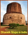
Pictures of ancient artifacts, ruins, sculptures, and religious monuments like the Great Stupa at Sanchi or carvings from Ajanta Caves bring history to life. These visuals help students connect abstract concepts—like religious practices, urban planning, or artistic expression—with tangible examples. They also promote engagement and curiosity, especially for visual learners. Together, maps and pictures provide context, deepen understanding, and support more active and meaningful learning about ancient India.
|